1. DRINNON/GWILLIM to the NORTH VALHALLAS
A route exists from the south at Hodr Creek and Drinnon/Gwillim lakes that continues north along the spine of the Valhallas. Several exit routes exist to the east down to Slocan Lake. The only exit to the west is out Caribou Creek from Wee Sandy Lake.
Each person should have an ice ax and know how to use it, and the party should carry a light rope in case of bad choice of route. Despite the low altitude, the terrain is very rugged and traverses through the Valhallas (especially the north part of the route) are not easy. Other than the road accesses at the north end at Shannon Lake and the south end at Drinnon Lakes and the trail from Evans Creek, all other access points are by boat from Slocan Lake. The following description starts at the south end of the traverse at Drinnon Lakes. This day-by-day itinerary is only a suggestion.
Day 1. Arrange shuttles – either by boat from several locations on the lake depending on exit point or a vehicle at Shannon Lake TH or Drinnon TH. Note that the last 2 kilometers of the road into the Drinnon trailhead is very rough and overgrown.
Drive up Hoder Creek and park at the Drinnon Lakes TH, the main southern start point/terminus of all traverses.
On the excellent trail to Gwillim Lakes, walk past Drinnon Lakes to Gwillim Lakes basin. Pass through the Black Prince/Lucifer col. Watch for ice on the descent from the col. An axe is necessary and late in the season, crampons could be handy. Descend to Rocky Lakes, a pretty place to camp.
Exit #1 Evans Lake. I knew people who did this. They even made it out alive. And unbelievably, they went back and did it again. They were truly mad. The bushwhack down to Evans Lake and around the lake is prodigious. The group actually constructed a raft and sailed down Evans Lake. From the end of Evans Lake, trend NE towards the east end of Beatrice Lake and the trail from Beatrice down to the lake over truly awful terrain. None of this is recommended.
However it might be the only way to see the Evans Lake cabin without flying in.
Day 2. Continue north walking between the two Hird Lakes and contour north and east to Urd Peak. Either traverse it descending the N ridge, Class 2-3; or possibly better, use the col east of Urd Peak (steep snow, perhaps ice). Descend to Upper Demers Lakes, the site of the 1978 KMC Hiking Camp.
Exit #2 Demers Lakes to Beatrice Lake and Evans Creek Trail. When I did the traverse, we camped between Demers Lake 2 and 3 and exited out Beatrice Lake. It was a very long day getting to the end of Beatrice Lake.
There are two steep descents between Demers Lake 3 and 4 and again after Demers Lake 5 down to the end of Beatrice. Walking the shore of Beatrice Lake is truly the worst bushwhack I have ever done. It was so bad that we actually tried walking in the woods – that was worse. There is an amazing amount of wood on the shore of Beatrice and it gets exhausting walking over and under the logs with a heavy pack. We all arrived at the campsite at the east end of Beatrice after dark and a 12-hour day. It was then an easy fourth day walking out the Evans Creek Trail to Slocan Lake. We had arranged a boat pickup. One could also walk out to Slocan City on the Slocan Lake Trail. Total 4 days, 32 kms long and passes 16 lakes.
Day 3. If continuing the traverse, north of Demers Peak, walk on the divide itself. Access it from the NW corner of Upper Demers Lake. Stay on the divide until approximately 493-276 and descend off the ridge to the Avis Lakes basin (headwaters of Beatrice Creek). This is another possible Day 2 campsite.
At Avis Lakes, traverse east on the divide to a col (Snow Creek-Beatrice Creek 534-293) 2450 meters (8050 feet). Here the divide is too rugged and one must travel on either the east or west side of the divide. On the east, access ledges 150-210 metres below the east side of the ridge.
End this section on the east side at Nemo Lakes. If day 2 campsite was at Avis Lakes, Nemo Lakes is a likely day 3 campsite.
Day 4. From Nemo Lakes, go over the col into Caribou Creek, or better, traverse east on the south side of the divide to the col north (or northwest) of Mount Meers at 583-331. Climb Mount Meers and descend its east side to the north end of Upper Wee Sandy Lakes. This was the location of the 1979 KMC Hiking Camp. Or descend to camp at the north end of Wee Sandy Lake.
Exit #3. Mount Denver and Sharp Creek Trail. Access the ridge due east of Mt Meers that continues onto Mt Denver. Descend the glacier and follow the ribboned route to the Sharp Creek Trail that leads down to Slocan Lake. A boat pickup would be required.
Exit #4. Caribou Creek (on the west side of the divide) via Mt Meers. From the col west of Mt Meers, go left (west) to access Caribou Creek and after a long day of bushwhacking, reach a logging road (and hopefully a vehicle) that continues to Shannon Lake FSR (see post “Shannon Creek to Wee Sandy Lakes” for route and driving instructions).
Day 5. To continue the traverse, the best route is to traverse above the trees under the east side of the Meers-Niord ridge, regaining the divide and ascend the south ridge of Mount Niord, traverse Niord.
Unless one were exiting the traverse at Wee Sandy Lake Trail, there is no reason to descend to Wee Sandy Lake – all by an unpleasant bushwhack. The lake is below the tree line and has are no redeeming features. If at the lake, pass Wee Sandy Lake on either side – there is no trail. Alternately, traverse down the east ridge of Niord to north of Wee Sandy Lake by another bushwhack.
Camp at Grizzly Lakes or at one of the Wee Sandy Lakes – upper, main or lower.
Exit #5. Wee Sandy Lake Trail. This is the most common terminus of most traverses. It is 14.4kms and one day on a reasonable trail down to Slocan Lake (going up is usually done in two days). The Iron Creek Cabin (previously the Holt Cabin) is approximately 4kms from Wee Sandy Lake. A boat pickup is again required. Wee Sandy Beach is directly across from New Denver, and is arguably the nicest campsite on the lake.
500m or 15 minutes from the lake, an old wagon road heads south to Sharp Creek along the lake. This is one of the many remnants from old logging.
Exit #6. Caribou Creek via Grizzly Lakes. There are two routes down. This is the most southerly of them: Grizzly Lakes are the two lakes north and northwest of Wee Sandy Lake. Stay high to the west above the large Grizzly Lake and contour to avoid bushwhacking. Ascend the very steep grassy slopes (use an ice axe for safety) to the pass (one of two; 584-387) just south of Un. 2640m at the Un. 2640m-Niord col and west-northwest of Grizzly Lakes. From the pass, descent to the NW (bear trails through grass) to find a road (high clearance, four wheel drive, low range) above tree line where the valley is flat. Follow the road for 2kms to the junction with the Caribou Creek FSR where it makes a big indentation (about 550-417). From here it is 7km to the summit of the pass leading down to Shannon Creek. Refer to the post “Shannon Creek to Wee Sandy Lakes” for details of both these routes.
If continuing the traverse north, it is best to traverse Mt Niord, come off the north ridge and contour around the basin above Grizzly Lakes.
You now need to decide to other walk the divide to Shannon Lake Basin or descend to the north side of Skadie ridge and contour above the “upper Wragge Lakes” at about the 7,000 foot level.
The ridge following the watershed between Wee Sandy and Shannon basins is described as spectacular. Five kilometres long, it is narrow, has minor scrambling, undulates gently and gives awesome 360° views both ways. Access the ridge from the col to the north of UN 2640. The peak on the south end of the ridge is Skadie Peak 8600′.
At the north end of the ridge, it is a 600m steep, narrow traverse east to a gully and the Vingolf col.
To access the ridge from the north (Vingolf) end, when almost at the Vingolf col, turn right up another gully to take you up to S facing slopes at 7800′, then a steep traverse west 600m to the N-S ridge.
If not following the ridge (the watershed), cross the ridge separating the Wee Sandy and Wragge Creek watersheds (Skadie Ridge), descend to the two small Upper Wragge Lakes. If descending out Wragge Lake (not recommended), turn right (east) and try to find the best way down to the lake. Contour above Wragge Lake at about the 7,000 foot level.
Exit #7. Wragge Lake and Creek. This descent has been done but has horrendous bushwhacking. It is a 2000 foot descent from the two small upper Wragge Lakes to Wragge Lake through terrain so steep that “one feels like they are free-falling down the mountainside barely averting disaster by grappling onto the alder bushes”. It doesn’t improve at Wragge Lake where the bush is so thick around the lake that it is faster to just wade through the waist-deep water along the shoreline. An old overgrown ATV trail exists along Wragge Creek (initially on south side of the creek) that descends 5kms to Wragge Creek FSR.
A better way may be to backpack over Un. 2638m (“Wragge Peak”), directly south of Wragge Lake, and descend this mountain’s north side to the lake, trail and road.
Day 6. If you have decided to not take the easiest exit from the traverse at Wee Sandy Trail, ending at Shannon Lakes is much easier than going down Wragge Creek. If you have decided to do the entire south/north traverse of the Valhallas following the watershed, then you would want to finish at Shannon Lakes anyway.
From the upper Wragge Lakes, contour into the valley with two small lakes northwest of Wragge Lake. This could be a last campsite. Or camp at Shannon Lake.
Access Shannon Lakes via One Goat Pass to the west of Mount Vingolf. Descend to the west side of upper Shannon Lake and then down the boulder fields to the north end of the Shannon Lake and the trail along the west shore.
It is the 1.6km down Huss Creek to the parking area on Shannon Creek FSR.
Refer to the post on Shannon Lakes for road access to Highway 6 and Hills.
2. MULVEY BASIN to DRINNON LAKES
This high level traverse served as the access to Drinnon/Gwillim before the trail up Hoder Creek was developed. When the coin was flipped from 1980 to 1989 and Bannock Burn FSR was closed so there was no easy access to Mulvey Basin, this route again enjoyed some popularity as a result of necessity. Parks decided to remove the cairns in the mid 1990s for safety reasons (I don’t quite understand that logic). Apparently some inexperienced souls had some problems on the traverse that entails going over 3 ridges.
Start at the Gimli Ridge/Mulvey Basin trail. Ascend the trail to the saddle below the south ridge of Gimli and either go to the ridge, descend down the steep snow/ice and work your way west to the Niselheim/Midgard col or start on the trail that goes to the ridge, drop off the trail and work around the south base of Niselhiem.
Contour to the west under Midgard and the East, Centre and West Summits of Mount Prestley. This is a pleasant ramble on good rock. Continue under Unnamed 2730, the last significant peak of the Prestley Group on the ridgeline.
Pass through the col to the west of UN2730 and descend due north directly to Valhalla Lake. Camp.
From Valhalla Lake contour west under the north face of Drinnon Peak ascending to cross the NW ridge of Drinnon Peak.
From the ridge, descend SW to Drinnon Lake and the trail out to Hoder Creek.
3. McKEAN LAKES to BLACK PRINCE /MT BOR COL
This was mentioned by Earl Whipple as a way to access the south end of the traverse of the Valhallas. This route never occurred to me and seems like an unusually difficult way to get there. First go up the McKean Lakes Trail (4700′) to McKean Lakes (6900′) then through the basin to McKean Pass to the SE of Woden and “Little Woden” (7900′). Trend NE and east over the divide between Woden and Hoder Creeks with several ups and downs. Then contour NE and north around the west side of Black Prince into the Bor/”Buri”/Black Prince col. Descend due east and turn north to pass Rocky Lakes.!??
THREE MEN RUN the VALHALLAS in ONE DAY
This summer three Nelson men accomplished a world first by running, scrambling and bush-bashing the entire length of British Columbia’s Valhalla Provincial Park, from south to north, in under 24 hours. That’s about 52 kilometres over six mountain passes – in a day! Ultra-runner Randy Richmond shares the story of their adventure,
 Running along the Mt. Meers ridge to try and find a way down from the pass.
Bucket lists can be great motivators, providing a spiritual launch forward to fill up a “life’s cup” of journeys. For four years I had to keep moving my summer Valhalla traverse adventure onto next year’s list – maybe with good unconscious reasoning. I’m approaching my mid-50s so the pain and suffering is no longer masked by adrenaline; instead I am left with good ol’ basic nervousness. Well, fear actually.
The date was July 23, 2016, and evening was falling as our vehicle slowly rounded the corner of the rough Hoder Creek forest service road. Suddenly two majestic cougars came into view looking startled before quickly disappearing into the dense bush – the same bush we were going to be running through in a few short hours.
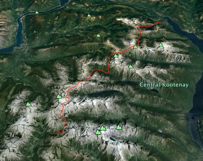
The trio’s route through the Valhalla Provincial Park.
By the time we got to our southern access point in Valhalla Provincial Park it was well past dark so I lay down on the ground to try and get some sleep. I’m not sure if it was the cougars or the anticipation of what was in store but shut-eye never came. So I cancelled my alarm and jealously woke my friends out of a deep sleep at 2:30 am.
There are not too many buddies who can get excited about a fast traverse of the entire Valhalla mountain range in one go, but Chris Rowat and Nelson Rocha never even batted an eye when I suggested it. There are no trails once you access the heart of the Valhallas, except the first few kilometres to Gwillam Lakes, and we’d need to cross six mountain passes before descending into Wragge Lake and out to the junction of Shannon Creek FSR just above the town of Hills on the northern end of Slocan Lake.
We estimated 15-18 hours for the entire traverse but calculating travel time through the mountains, especially without any trails, is a wild ass guess at best.
• Chris led the charge at 2:30am Saturday morning and we gained 900 metres to the first pass, Lucifer Col, in two hours. We were rewarded with a spectacular sunrise followed by a fun “shoe ski” descent down the north-facing snow-filled slope.
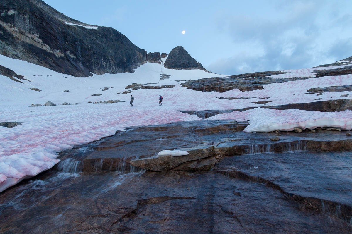
Coming down from Lucifer Col
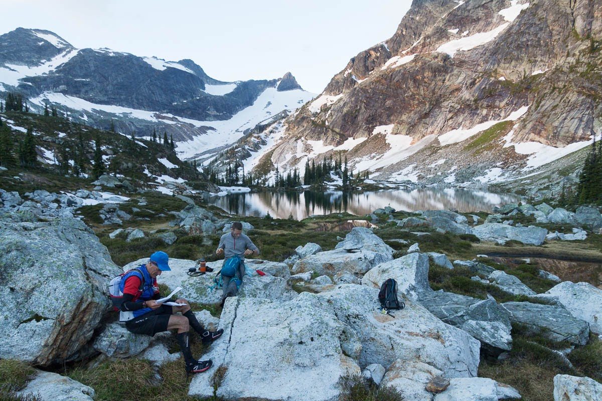
Rocky Lakes
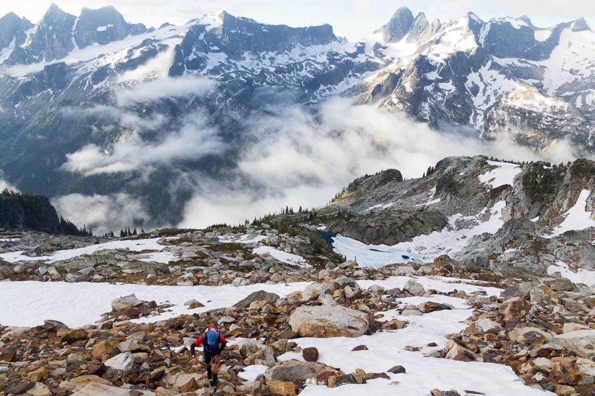
Near the east shoulder of Urd Peak with Devils Range in background.
We made great progress over the first three mountain passes and we soon came to appreciate that travelling south to north was the best choice because it provided us with dry rock on the southern aspects followed by the north slopes still filled with snow, which made for quick descents.
• As we rounded Demers Peak and started descending into the next valley it became obvious our speedy travel was about to come to an abrupt halt. At 1,600 metres we were no longer in the alpine and instead had to deal with thick forest, bushy alder slide paths and marshy creeks. We had long given up worrying about wet feet as we trudged direct lines through the marshes so as to avoid the alder. We spoke seldom except to discuss route options and it took us four hours just to cover that one valley.
• We then traversed around Hela NW4 Peak and up Mount Meers and it was getting late in the day when we spotted Wee Sandy Lake and our sixth and final climb up the Skadi col.
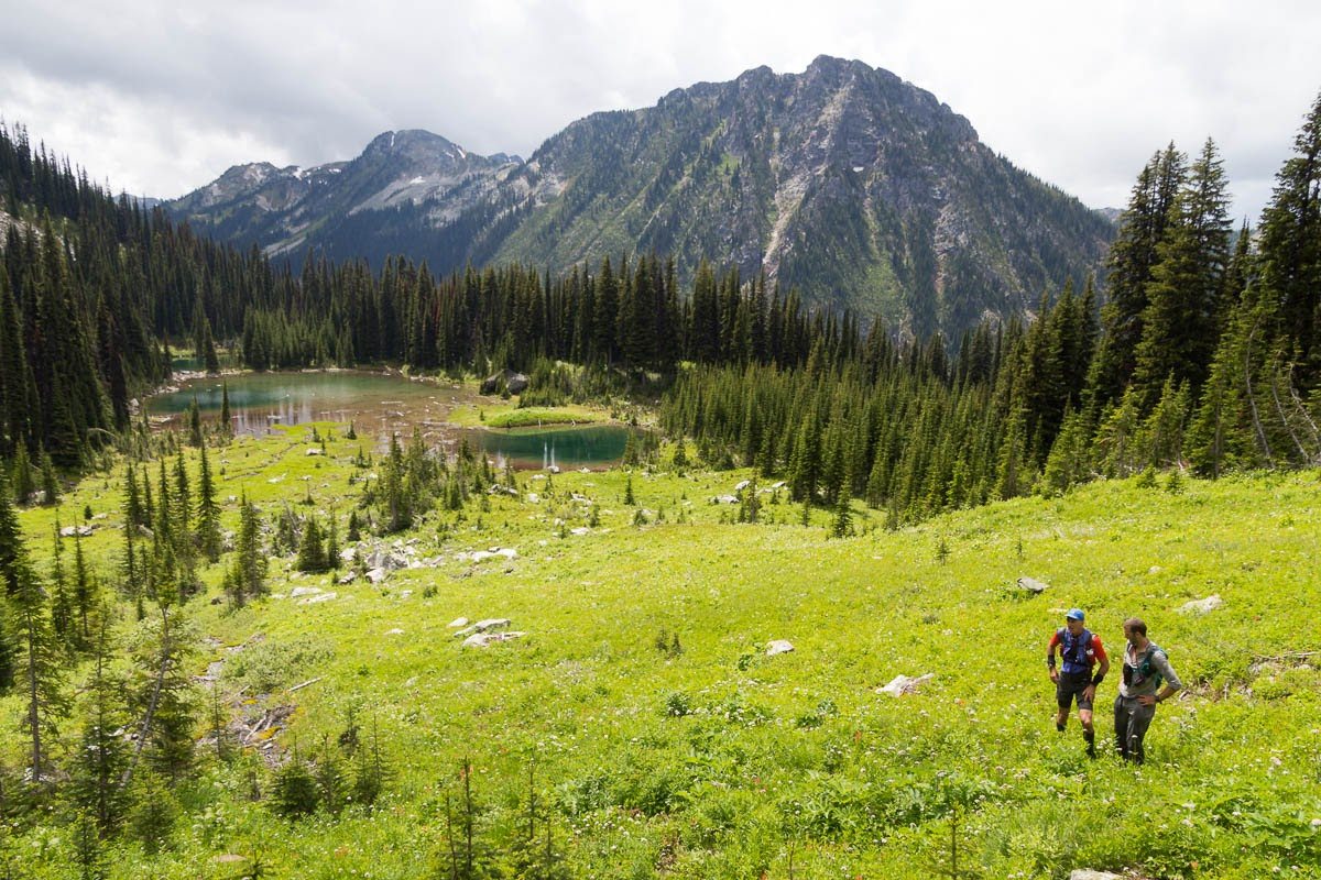
Around the west side of Hela Peak
Our estimation of a 15- to-18 hour traverse was now out the window and weak thoughts started creeping into my consciousness. “If I just twisted my ankle, a helicopter rescue would end this suffering,” I thought. And “Maybe we should camp here and get going tomorrow.” This wasn’t my first rodeo, though, and I knew what to do. I glanced over at Chris and Nelson and they too were showing signs of fatigue and I muttered, “Water break time.” I then pulled out my emergency pouch and grabbed a can of Coke. I’d been lugging it around for 17 hours but it was worth it: I drained it all in one go. It only took a few seconds to feel that heavenly rush of sugar flowing through my veins. I was powerful once again.
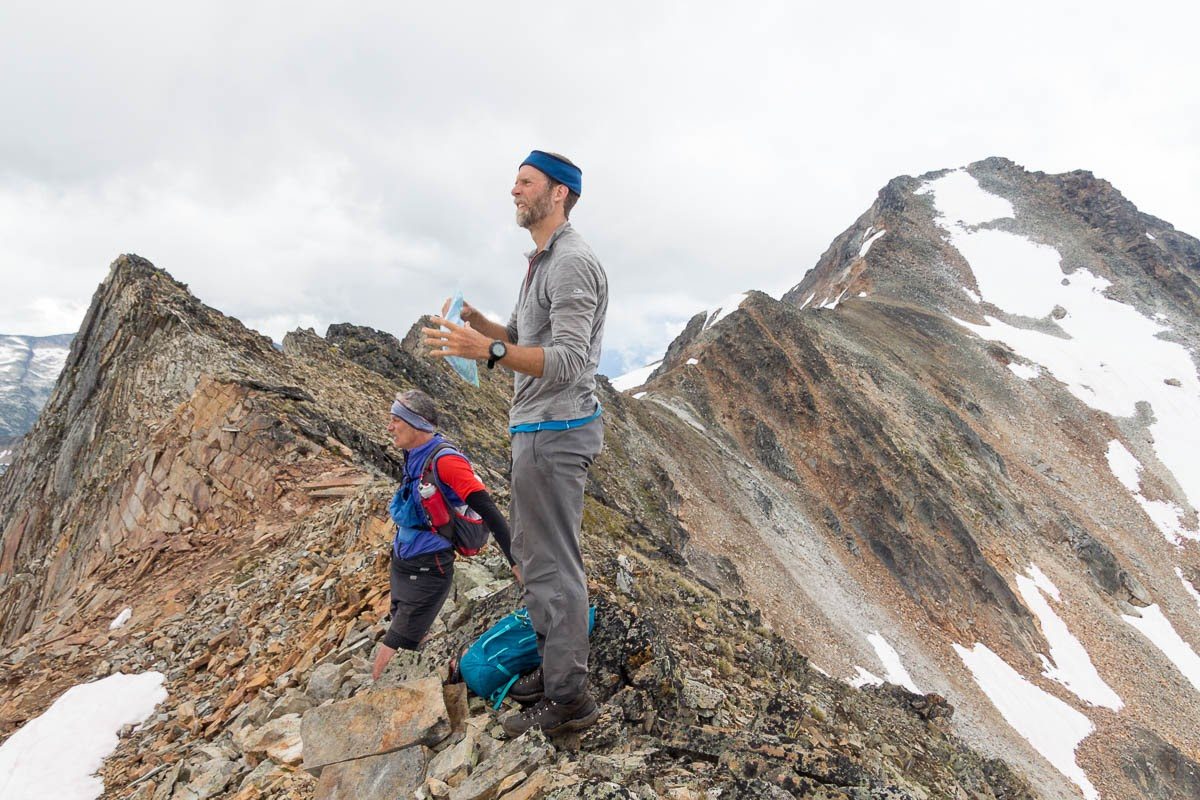
The ridge between Mt Meers (in the background) and Mt Niord.
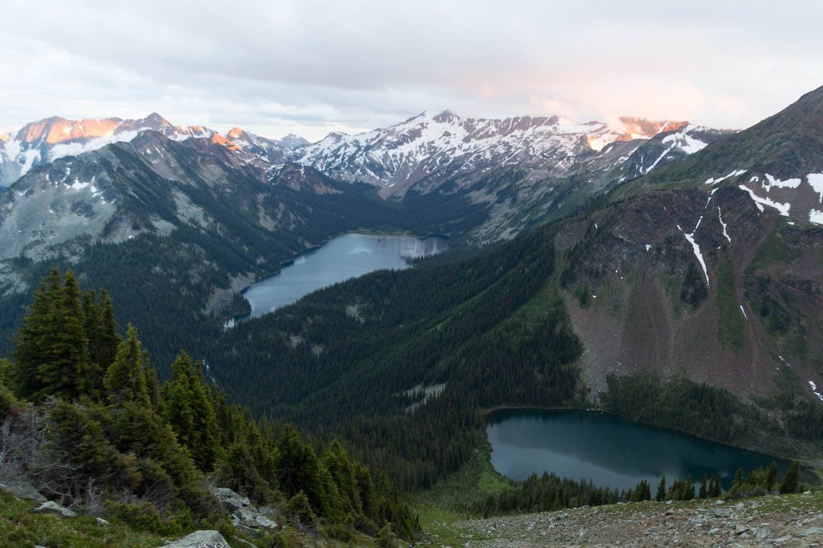
View from Skadie Pass with Wee Sandy Lake in the background
• The bush was so thick around Wragge Lake it was faster to just wade though the waist-deep water along the shoreline. We gained the last climb just as daylight ran out and then braced ourselves for the challenges that total darkness would bring for the final descent. I thought of a quote from Joseph Conrad: “There it is before you, smiling, frowning, inviting, grand, mean, insipid, or savage, and always mute with an air of whispering, ‘Come and find out.’”
The terrain became steeper and we were almost free-falling down the mountainside, barely averting disaster by grappling the alder bushes. Light was limited to our headlamps, which only illuminated a few feet in front of us and route finding became near impossible. One wrong step and we’d launch ourselves off a cliff. Finally Nelson found the one little gap through the steep terrain but it led us to another slope completely filled with Devil’s Club, a spiky poisonous plant that we tripped and tumbled through.
After what seemed like forever we reached the 500-meter-long Wragge Lake but our ordeal was not yet over. Those 500 meters took us an hour to navigate! That works out to eight metres per minute and we were going hard but the darkness and lack of food had taken its toll. We were now 22 hours into our “fun traverse” and I again started to think about Joseph Conrad’s novel and how Charlie Marlow penetrated deeper and deeper into the heart of darkness.
• Finally we stumbled onto the old trail leading out of Wragge Lake, looking like a pack of zombies. With one last push we made quick progress down the FSR to our truck. We said we wanted to do this whole traverse in a day and when I looked at my watch it read 23 hours and 58 minutes. I was too nauseous to eat and too tired to lay my sleeping pad on the ground so I crawled into the front seat, pulled my sleeping bag over my head, and drifted off thinking once again about the Heart of Darkness and our journey through the Valhallas. “It was like travelling back to the earliest beginnings of the world, when vegetation rioted on the earth and the big trees were kings. An empty stream, a great silence, an impenetrable forest.”
Their Mistakes (Ron Perrier)
They did well until leaving Demers Lake and coming off Demers Peak – a long ridge with 2 bumps the most westerly on the watershed. Instead of starting a long bushwhack, they need to stay on the ridge line for the next 1.5kms descending at 493 273 into the alpine and contour above Avis Lakes.
Getting around Hela Peaks (at least 4 summits on a long 3.5km ridge with the most westerly on the watershed) is usually done by descending to the west and traversing around this rugged ridge line. This posed no issues for them.
Stay on the ridge above Wee Sandy Lake go over the summit of Mt Niord. No reason to go down to the lake.
Their major mistake was the descent out Wragge Lake, a disastrous bushwhack. Much easier to continue on the ridge between Mt Skadie and One Goat Pass (Mt Vingolf) and descend to Shannon Lake, the Shannon Lake Trail and parked car.
