Maastricht & Area July 5-6, Central & Utrecht July 15-17
CENTRAL NETHERLANDS
NIJMEGEN (pop 171,000). Situated on Holland’s busiest waterway, the Waal River, it is also the home to about 13,000 students in the Netherlands ’ only Catholic university.
History. The Romans conquered it in 70AD and promptly burnt it down. It built itself up as a trading and manufacturing town and was invaded repeatedly over the centuries. WWII was devastating as it was a marshalling point for the German forces and was bombed heavily in February 1944 by the Americans. Later that year it was pummeled during the Operation Market Garden fiasco.
Valkhof. In a commanding position overlooking the Waal, this is a lovely park with a ruined castle and 16-sided Sint Nicolaaskapel, that dates from Charlemagne’s time and has been remodelled numerous times.

I arrived in the middle of the Valkhof Festival and it was mad with people: under the bridge on the beach and up in the park, plus a big midway further down the river. It was one big beer garden with at least 4 stages playing canned music or live bands.
Arnham (pop 153,000). With its centre levelled in WWII, it has rebuilt with the fashion and design industry.
A Bridge Too Far: Operation Market Garden. This battle was devised by British General Montgomery to end WWII by Christmas 1944, this was a total disaster. The plan was to make a huge push along a narrow corridor to Arnhem to cut off large numbers of German troops from being able to return to Germany. Everything went wrong: the paratroops had only 2-day rations and the forces from the south had to cross 14 bridges, all of which had to be traversable and lightly defended for the plan to work. They encountered some of the German army’s most hardened troops and the bridges weren’t all intact so the paratroopers became stranded and held out in Oosterbeek for 8 days without reinforcements. 2000 retreated under darkness and more than 17,000 British troops died.
It was devastating for the Dutch as Arnhem and other towns were destroyed and hundreds of civilians were killed. The Dutch resistance, thinking that the war would soon be over, came out of hiding to fight the Germans and hundreds were captured and killed. Montgomery abandoned the area and the winter of 1944-45 came to be known as the ‘Winter of Hunger’ as no food could be imported from Allied-held Belgium.
Hoge Veluwe National Park. This 55 sq. km park is the largest in the Netherlands. It consists of marshlands, forests, heath, and drifts sands all well documented in the great museum at the visitor centre in the heart of the park – displays are on the flora and fauna (wild boar, rams, and red deer), the different environments, both above and below the ground. There are three entrances with ticket booths – the closest is from Arnhem. There are myriad biking paths and 42 km of hiking trails, with two routes signposted. A 100-site campground is at the Hoenderloo entrance. Free bikes are available at the entrances.
The land was purchased in 1914 by Anton and Helene Kröller-Mülller, a wealthy German-Dutch couple as a hunting ground. She wanted a museum and they built the Kröller-Müller Museum containing great art with Van Gogh’s The Potato Eaters and Weavers, plus most of the great impressionists.
HANSEATIC LEAGUE
This powerful trading community was organized in the mid-13th century – seven Dutch towns along the Lissel River were members: Hasselt, Zwolle, Kampen, Hattern, Deventer, Zutphen, and Doesburg. These towns became prosperous quickly through the import and export of grain, ore, honey, textiles, timber, and flax. It defended its ships against attack but worked hard to prevent war among its partners as the war was bad for business. They entered into monopolistic trading agreements with other groups, such as the Swedes, and achieved their powerful trading position through bribery, boycotts, and other corporate methods.
Its demise when the traders of Amsterdam in the 15th century essentially beat the league at its own game, outmuscling it in market after market.
Apeldoorn. In the NM small town series, Apeldoorn is more an agglomeration of several towns but still a compact centre. Palais Het Loo. Built in 1685 for William III, it details the House of Oranje-Hassau.
Deventer (pop 100,000). It was a busy mercantile centre by 800 and maintained its prosperity for centuries, as evidenced by its detailed old buildings. The Brink is the main square with many Hansa-era buildings.
Zwolle (pop 122,000). Another NM European City, Zwolle was the main trading port for the Hanseatic League and became a cultural centre. A moat and ancient fortification surround the town.
Giethoorn (pop 2600). This is the highlight of the region – a town with no streets, only canals, walking paths, and bike trails. Contrary to most Dutch geography, it is built on water crossed by a few bits of land and farmers even used to move their cows around in rowboats filled with hay. It is a very popular place in the summer when people bike or rent electric boats or canoes to find the maze of sleeping options: campgrounds, rental cabins, B&Bs, and hotel rooms.
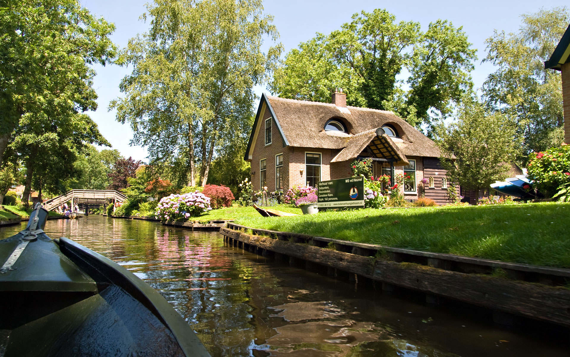
Weerribben-Wieden National Park. At 10,000 hectares, this is the largest freshwater wetland in NW Europe. Once worked by peat and reed harvesters, the elongated ditches across the landscape are the result of peat removal: as one line of peat was dug, it was laid on the adjoining strips of land (ribben) to dry.
There are two parts to the park. In the north is the characteristic striated landscape; to the south is an earlier stage of peat extraction, much of which was swept away by storms and is now covered with lakes. Peat digging ended but reed cutting for roof thatching continues today on a small scale. It is an important nesting area for several birds and a variety of orchids grow on the reed beds.
There is an extensive network of cycling trails.
FLEVOLAND. This is the Netherlands’ 12th and youngest province, a masterpiece of Dutch hydro-engineering. From 1927 to 1932, an ambitious scheme reclaimed more than 1400 sq. km of land. The completion of the Afsluuidijk (Barrier Dyke) paved the way for its creation. Ringed dykes were erected, allowing water to be pumped out at a snail’s pace. The Noordoostpolder was inaugurated in 1942, followed by the Southeastern Flevoland in 1957 and Southwestern Flevoland in 1968. The first residential rights were granted to workers who’d helped in reclamation and to farmers, especially those from Zeeland, who had lost everything in the great flood of 1953. The main cities that sprang up are Almere, Lelystad, and Emmeloord, all dull places laid out in grid patterns. The top highlights are the old fishing villages Urk and Schokland.
Schokland. These islanders eked out an existence for hundreds of years on a long, narrow strip of land in the Zuiderzee. By the mid-19th century, fish prices plummeted and vicious storms were eroding the island away. They hung on despite the appalling living conditions but their removal was ordered by Willem III in 1859 and Schokland was eventually swallowed up by the Noordoostpolder in the 20th century.
See the Schokland Museum to learn all the history of the area, now a Unesco World Heritage site. Views from the lower path hint at how big the waves were at the prow-shaped barrier, constructed from tall wooden pilings. Since the area was drained, the foundations have begun to dry out. It is sinking but no longer into the sea. There is a 10-km route around the old island.
Lelystad. The capital of Flevoland province was founded in 1967. It has unattractive modern architecture. The Batavlawerf is home to a replica of a 17th-century Dutch merchant frigate, the Batavia, that took 10 years to construct. The original was a 17th-century Titanic – big, expensive, and supposedly unsinkable. But filled to the brim with cannon and goods for the colonies, it went down in 1629 on its maiden voyage of the west coast of Australia. This ship sailed around the Pacific in 2000.
Oostvaaderplassen Nature Reserve. Just south of Lelystad, this is an NM national park.
Sanatorium Zonnestral. Located in Hilversum, northeast of Utrecht, this was a tuberculosis sanatorium intended for diamond workers and now closed for many decades. It has been declared a Unesco World Heritage site in 2010. Before the introduction of effective antibiotics for TB, treatment consisted of treatment in sanatoriums located in rural areas, rest, and collapsing the affected lung (with induced pneumothoraxes and weights placed on the chest).
The three buildings were built between 1928 and 1931 – the main building with 3 parallel wings and two pavilions on each side. This sanatorium is a park-like setting and is most known for its architecture: concrete white buildings with walls of glass and distinctive steel window frames in a specific light blue. An extensive restoration occurred in the 1990s costing 12 million guilders. It is now used for a variety of businesses and the interior of the actual buildings can only be visited on a tour.

UTRECHT (pop 335,000)
This is one of the Netherlands’ oldest cities with a compact medieval core set out around canals unique to the country. There’s a lower level where the warehouses were located in the 13th century. Roads are being turned back into canals, the concert hall has five venues and there is a new train station. Utrecht’s student population of 40,000 is the largest in the country.
History. In Roman times, the Rhine passed through Utrecht, then called Trajectum. Through the following centuries, it had religious ties and was part of various empires. By the 11th century, it was a centre of culture and learning while Amsterdam was a grubby fishing town to the west.
In 1579, several regions of today’s Netherlands united under the Union of Utrecht. The Protestant religion was made official but Catholics were not persecuted. The university was founded in 1636. In 1702, the bishop of Utrecht was booted from the Catholic church for failing to recognize the pope’s infallibility, and the Old Catholic Church was founded. Its popularity peaked in 1889 when disgruntled Catholics met in Utrecht but then diminished so that the church has less than 10,000 members now.
Domtoren. A remnant of the original 14th-century cathedral, this tower is 112m high, with 50 bells. It’s worth it to climb the 465 steps up for views of Amsterdam. The visit is by guided tour only. Following almost 300 years of construction, in 1674, hurricane-force winds blew down the nave leaving only the tower, transept, and chancel we see today.
Cathedral Church of St Gertrude. There are paving stones that mark the extent of the nave and the position of the columns.
Museum Speelklok. This has a colourful collection of player organs (including many huge street organs), mechanical instruments, and clocks.
Centraal Museum. Applied arts are the heart of this wide-ranging collection with paintings by De Stijl and a 17th-century dollhouse.
Nederlands Spoorwegmuseum (Dutch Railway Museum) This features historic trains, including the luxurious cars of the Orient Express, Holland’s oldest steam locomotive, model trains, and displays in an old station building.

Rietveld Schröderhuis. This Unesco World Heritage site was built in 1924 by Utrecht architect Gerrit Rietveld for socialite Truus Schoöder-Schräder as an example of ‘form follows function’. He used primary colours and unusual transitions between the interior and exterior. Visits are by mandatory tour booked in advance online. Nearby are a pair of social housing blocks also designed by Rietveld.


SOUTHEAST NETHERLANDS
In the area below the rivers (the Rhine formed the northern border of the Roman empire), the provinces of Noord Brabant and Limburg have a southern character: more Catholic, better beer and food, and hillier.
As the Maastricht area was so close, I visited here from Tongeren and then returned to Belgium into East Flanders.
BREDA (pop 181,000)
Close to the Belgium border, it doesn’t have the most beautiful historic core, and I came to see a park.
Valkenburg. This idyllic park has big open spaces, two fountains, mature trees, and is a great place for a stroll. There is an odd lighthouse in a canal designed by an architect.

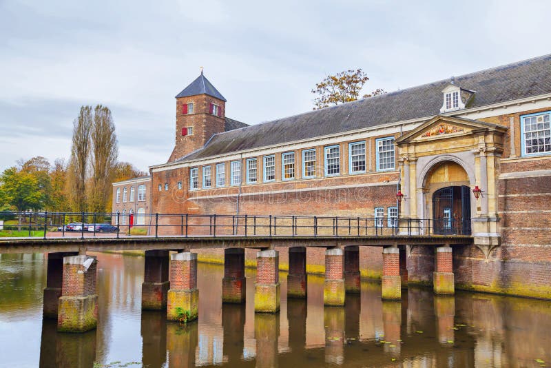
Breda Castle (1568-1648). At the edge of the park across a canal/moat, this remnant of Breda’s fortified era is still an active military base and off-limits to the public. But you can walk around the perimeter. It was made a military academy in 1848 and still is today.
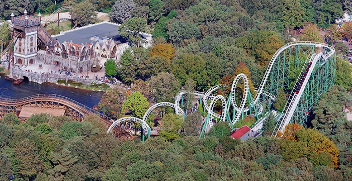
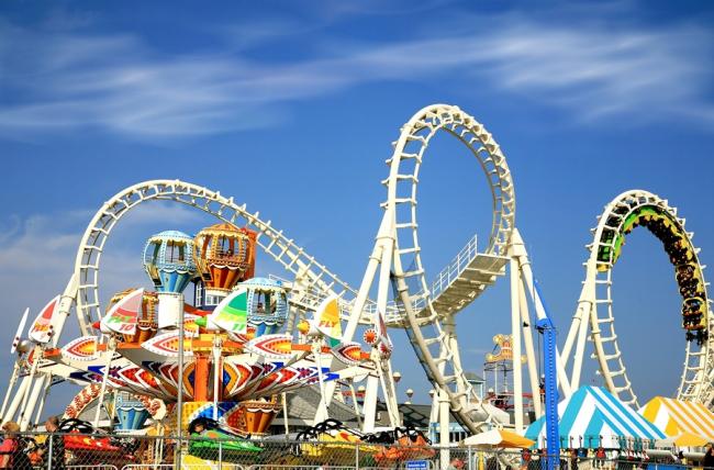
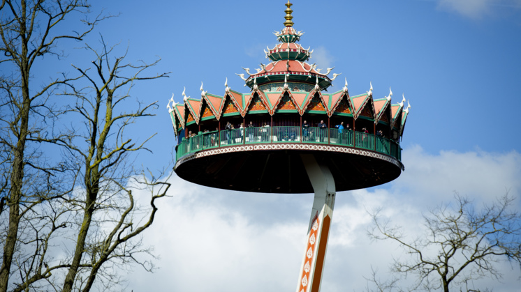
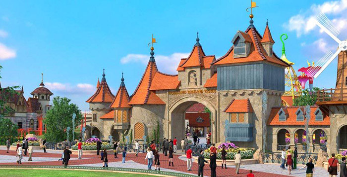
Eftaling Amusement Park. About 20kms NW of Breda in the town of Kaatsheuvet, is the ‘Dutch Disneyland” with over 4 million visitors per year. The mammoth parking lot was barely used despite the huge crowds that were here on this hot July Monday. The entrance is a wonderful area of 4 thatched spikes built on a log frame. Inside are huge rides, scenes from popular stories and fairy tales, live shows performed by “talent”, pickpockets and shrieking kids. €40
Oisterwijk. Another hard-to-understand NM “small town”, is a bedroom community full of palatial homes set in mature forest. I didn’t see a business. I drove a lot of back roads to get here and then drove all the narrow roads to get out, but it was pretty.
Tilburg. An NM “European city”, there is not much to see in this former textile city. There is a Textile Museum, a monument to its leading industry for over a century. I bought groceries at an Aldi, but they didn’t take credit cards (I have been shopping at Aldi for over 4 months and this only happens in Dutch Aldi) so left a large bag of groceries at the till and went to Lidl.
Baarle Hertog and Baarle Nassau. In the NM “XL” series, I drove almost to the Belgian border SW of Tilburg to get here and then drove most of the same way back to get to Eindhoven.
I am not sure what the significance of the area is but believe it is a Belgian enclave, as it sits just north of the border. One of the churches had a sign for Commonwealth War Graves – the 7 difficult to find, but typical gravestones for English soldiers were dated October 1944, when this area was liberated. The large church in town had a memorial to 50 Polish soldiers on the same date.
EINDHOVEN (pop 225,000)
A mere village in 1900, it grew exponentially thanks to electronics giant Philips, founded here in 1891, to become the Netherlands’ 5th largest city. In 1997, Philips moved to Amsterdam, but Eindhoven remains a centre of high-tech research and industry with a top technology institute (the Dutch Design Academy in the ex-Philips lamp factory), and is a magnate for ‘knowledge workers’ from abroad.
Perhaps it is better known to the traveller for the many budget carriers serving its airport.
Philips Museum. Starting in 1891 with the incandescent light bulb, Philips invented or developed virtually every piece of electronics all kinds of light from fluorescent to halogen to LED, radios, CDs, television, every kind of home appliance, men’s shavers, and much medical technology (X-ray, CT, MRI. Surprisingly this museum was open on a Monday. Free with MC.
Kasteel Heeze. 20 km east of Eindhoven, park at the brick arch out by the road and walk 300m along a cobbled road through a field to this private brick chateau surrounded by a moat but with an otherwise plain exterior. Tours are given on Wednesdays from 2-3 pm in July and August. kasteelheeze.nl €10
Helmond Castle. In the middle of the city, the moat of this small castle encroaches on its edges all the way around. It has four nice round towers on its corners. €8.50 free with MC
Croy Castle. NW of Helmond in the countryside, this imposing brick chateau is a bed and breakfast. It too has a large moat but is otherwise not fortified. The entrance to the establishment is on the north along a long lane.

AROUND MAASTRICHT
This area of the Netherlands hangs down from the rest of the country, surrounded on all sides by Belgium and Germany. It was this very precarious position that saved the area and Maastricht from war damage in the 20th century and the Dutch government didn’t bother mounting a defence.
Mheer Castle. In the NM Castles and Forts series, this castle is just over the border from the Ardennes. Enter a small courtyard surrounded by outbuildings to look at the moated chateau. It is private and can’t be seen.
Kasteel Schaloen. 10 km east of Maastricht outside the town of Schen op Galt and Valkenburg, this castle functions as a hotel and restaurant in the outbuildings. The moated chateau is private.
Valkenburg. In the NM ‘small town’ series, it is known for its recreated Roman catacombs installed in an old limestone mine, a ruined castle above the town, and hiking in the hilly terrain nearby. The palatial train station may be the best destination in town.
MAASTRICHT (pop 122,000)
This city with its closeness to Belgium and Germany has closer kinship with Europe than any other Dutch town. Captured in previous centuries by most of Europe’s powers it has a pan-European flavor and makes it all the more fitting that Maastricht was the site of two seminal moments in the history of the EU. The first was the signing of the then European Community of the Treaty for economic, monetary, and political union in 1991 by the 12 members. The following February, the nations gathered again to sign the treaty that created the EU.
The Maas River bisects the city in two. The Vrijhof is an expansive square surrounded by cafes, museums, and two great churches.
Sint Servaasbasiliek. Built around the shrine of St Servatius in the crypt, the first bishop of Maastricht, it dates from 1100. The sculpted wood choir, confessionals, and pulpit and the painted domes above the high altar are highlights.

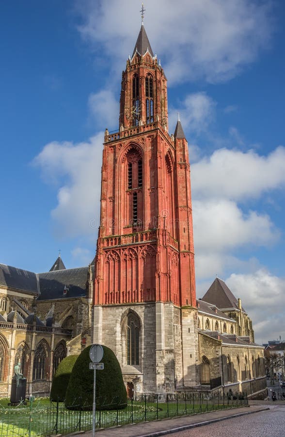
Sint Janskerk. This small 17th-century Gothic church behind Sint Servaasbasilik is among the most beautiful in the Netherlands. Originally the limestone tower got its red colour with a coat of oxblood but now is restored with ordinary paint. The church was closed but when open, it is possible to climb the 43m tower.
Museum Aan Het Vrijthof. Housed in Maastricht’s oldest civic structure (the café), the museum highlights the craft guild legacy of the city with silver, furniture, porcelain, timepieces, and weaponry. There was also a contemporary art exhibit that again I disliked. €8 concession.
Bonnefantenmuseum. The Lonely Planet describes this building as having a rocket-shaped tower but it is a red stone box housing early European painting and sculpture on the first floor and contemporary local artists on the second. Ugh. €9 concession.
Maastricht Underground. I didn’t go here but it sounds fascinating. The Romans painstakingly built these originally 20,000 separate passageways with a total length of 230 km extending to the Belgian border. Visit the Northern Corridor System Tunnels on two tours per day at 12:30 and 2 pm that start near Fort Sint Pieter. They are a constant 11° and 95% humidity.
SITTARD
In the NM ‘small town’ series (which you never know what there is to see), I could have easily missed this gem if I had stayed in the residential neighbourhood Google Maps took me to. But I drove towards the steeples of the central church, Toren Grote Kerk, found some parking, and discovered these amazing two places.
The Basilica of Sittard. In 1866, the area had an outbreak of cholera, and Maria, a local mother, sent her 3 daughters medallions of Our Lady of the Sacred Heart, advising them to wear them as protection against the epidemic. When the prayers were successful, it became a place of pilgrimage and a shrine was constructed, and then a church built in 1879. In 1883, it was named a ‘basilica minor’ and in a few decades, the membership of the basilica grew to 10 million from all over the world. Basilicas are not parochial churches and thus are dependent on the gifts from pilgrims. The other shrines to Our Lady of the Sacred Heart can be found in Averbode Belgium, Rome, Quebec, Sao Paulo Brazil, and Watertown USA.
The small church is an architectural masterpiece with high vaulted ceilings and pointed arches of differently coloured brick, painted columns and nice stained glass.
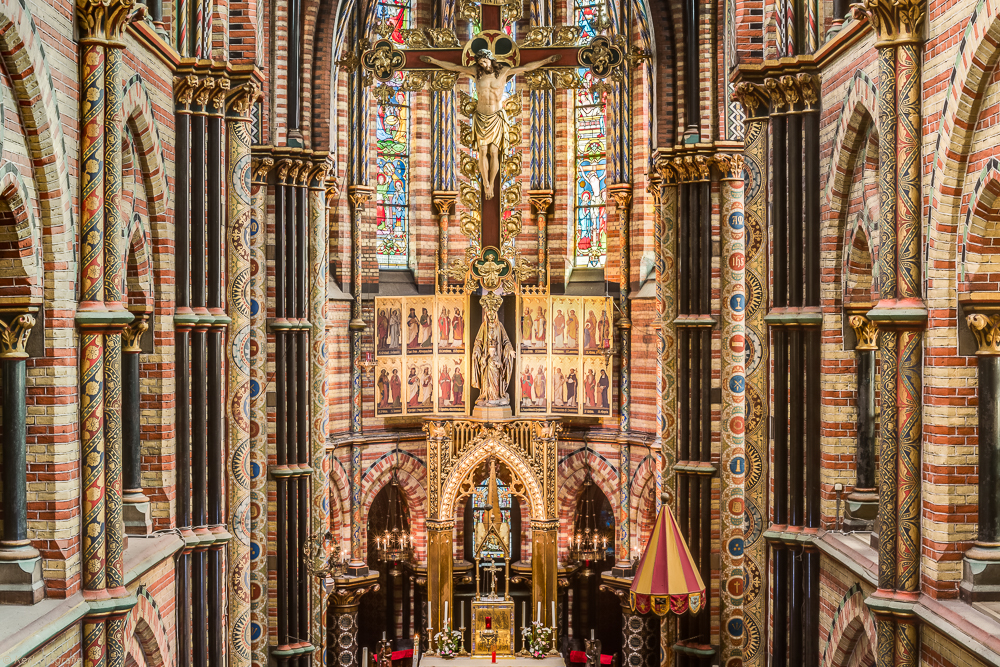

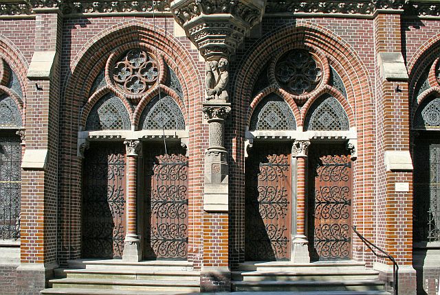
Maria Park. Opposite the basilica is this 1891 marvel of coloured brick and stained glass. It was built to house the pilgrims who came to the church. The Last Supper and Ways of the Cross are large sculpted stone bas-reliefs – the best I have ever seen.



Kasteelhof Born. North of Maastricht, this is a moated, ruined chateau in a park-like setting behind a large white bank. It is just off the central square of the small city of Born.
From here, I returned to East Flanders.
