
Wyoming
YELLOWSTONE National Park

Grand Prismatic Spring

Lower Yellowstone Falls. 308′ high. Grand Canyon of the Yellowstone River.
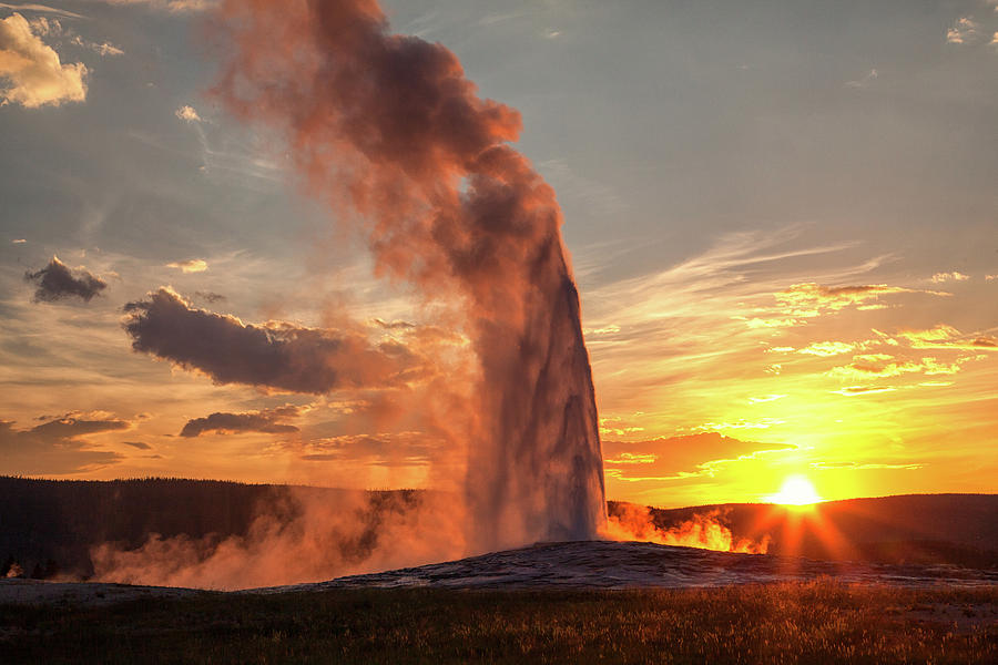
Old Faithful Geyser
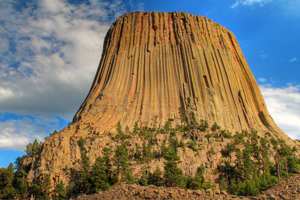
Devil’s Tower, Wyoming rises 1,267 feet (386 m) above the Belle Fourche River. It is the world’s largest example of columnar jointing. An easy 1 1/2 hr walk around the base.
Square Top, Wind River Range, Wyoming (11,695′, 3565m) is the most recognizable and photographed peak in the Wind River Range. In the foreground are the Green River and upper Green River Lakes. It was a huge hike to climb Square Top in one day. We came home in pitch blackness – with no headlights.

MESA VERDE National Park, Colorado: Cliff Palace Ruins, Long House, Spruce Tree House, Balcony House and Square Tower House. I saw Spring House on a special 100th-anniversary hike. Many day hikes to spectacular Anasazi ruins. Because of its higher elevation, Cedar Mesa was the last of the Colorado Plateau to be abandoned by the Anasazi in about 1350 AD.
/MesaVerdeNationalParkdarekm101-5711378a3df78c3fa2a2c5d3.jpg)
Cliff Palace

Spruce House
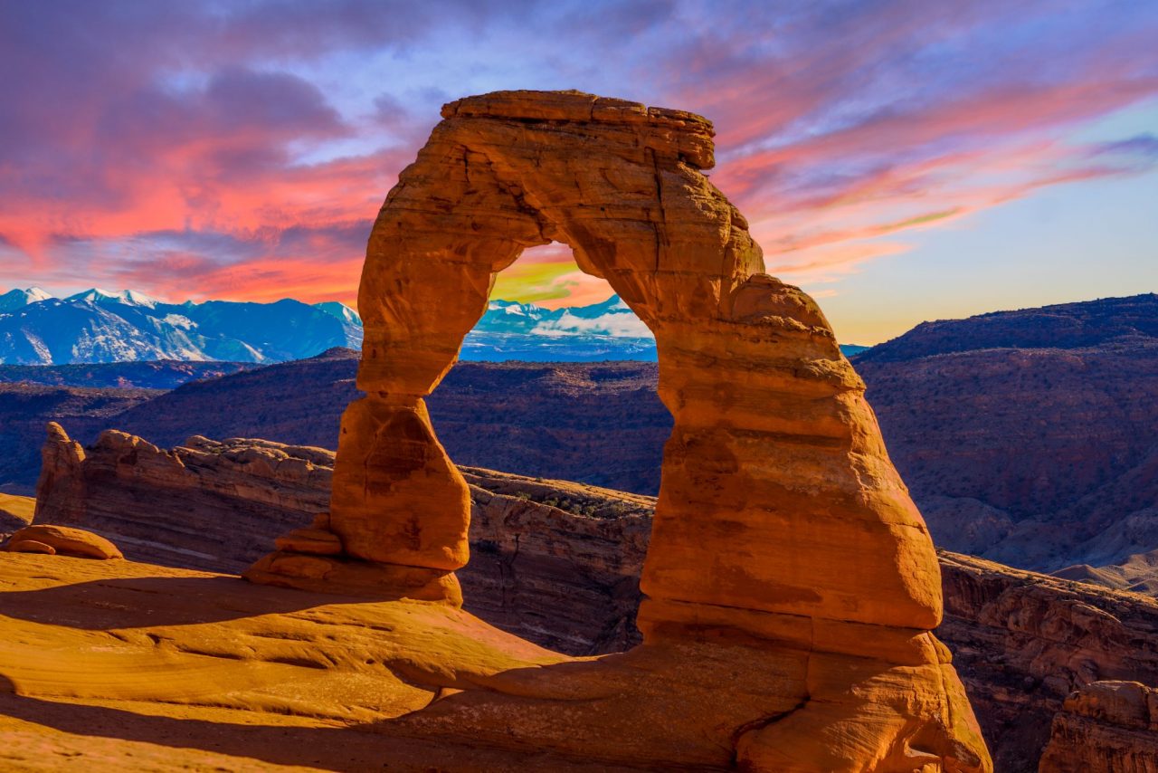
Delicate Arch. A popular place for sunset. A great hike.
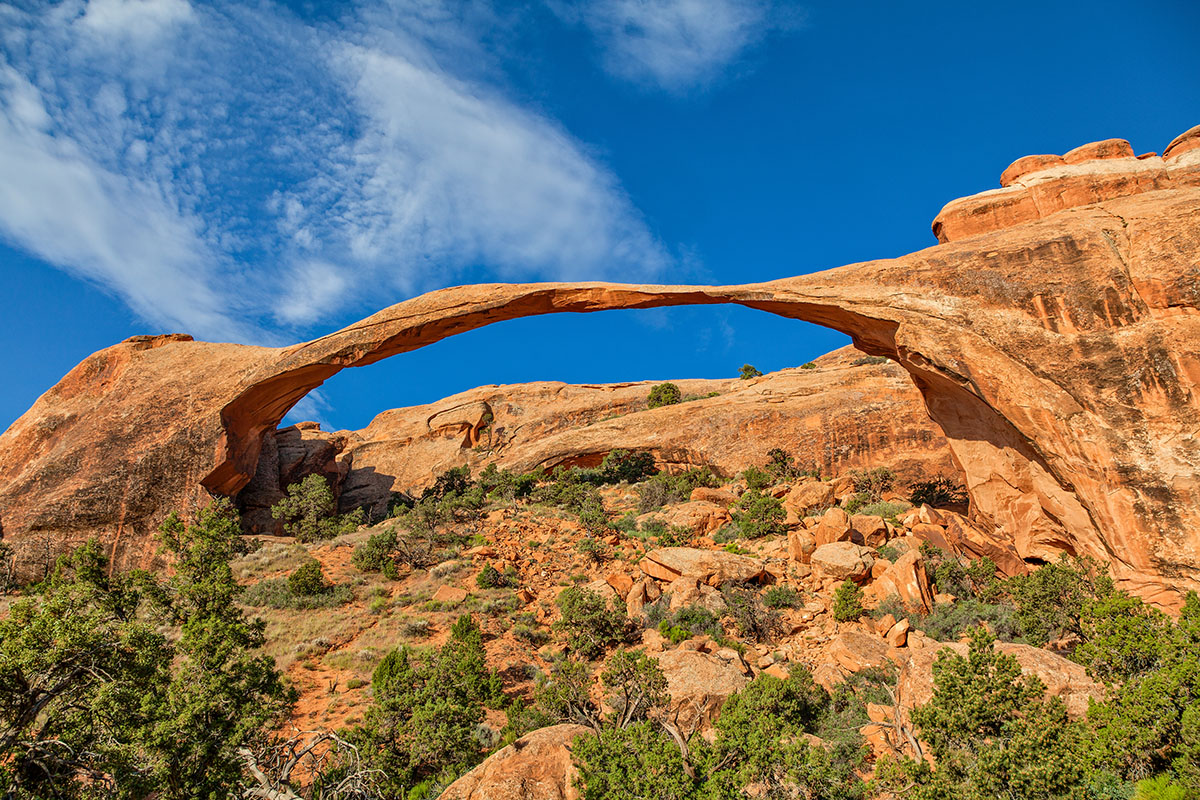
Landscape Arch. The longest arch at 290 feet, it has a gravity-defying ribbon of rock only 7 feet in thickness.
Tunnel Arch through North Window
CANYONLANDS NP
Island in the Sky: White Rim Road Drive, Upheaval Dome and Canyon Grand View Point, Musselman Arch
Mesa Arch. Beside the road.
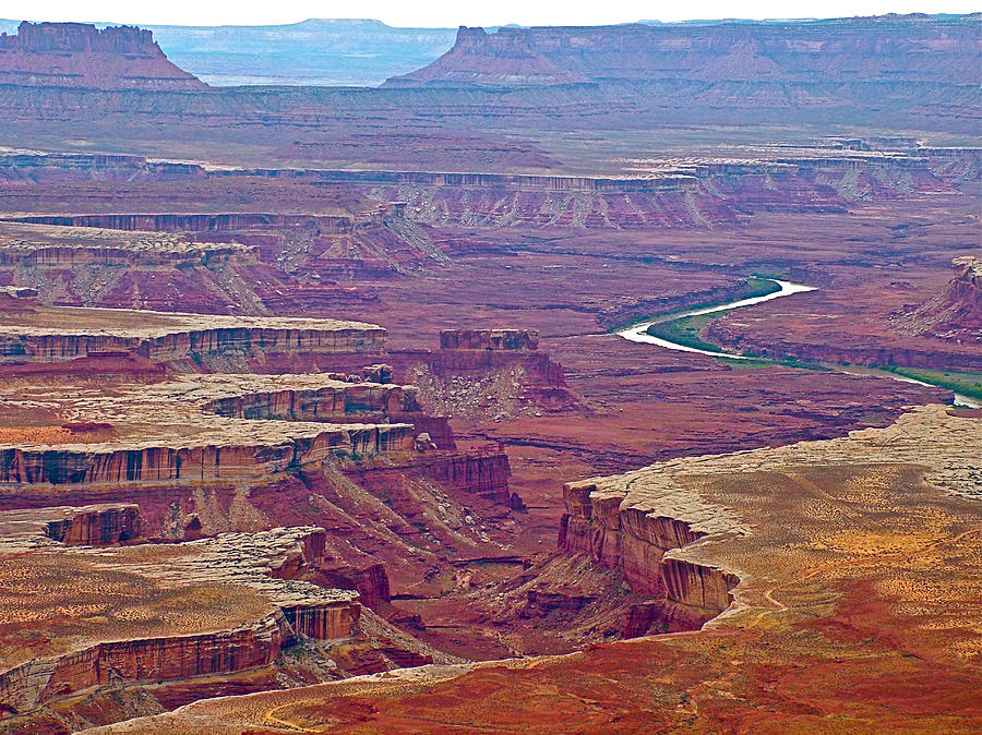
Green River Overlook from Island in the Sky
CANYONLANDS NP – The Maze District: South Fork, Shot and Water Canyons, Sweet Alice Canyon, Surprise Valley, Confluence Overlook.
My first trip involved a 1 km low-range 4WD drive around Teakettle Rock. We spent 4 days hiking in the Maze (Pictograph Fork, Confluence Overlook, Chocolate Drops), my favourite part of Canyonlands. My second trip was on the Green River Trip. We had day hikes up Shot Canyon and down Water Canyon and Sweet Alice Canyon from Spanish Bottom. Jasper Canyon is only one of two canyons in the entire Colorado Plateau that never had cattle. It is pristine and part of the Maze.

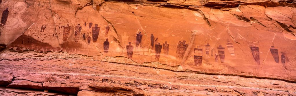
Pictograph Fork (Harvest Scene)
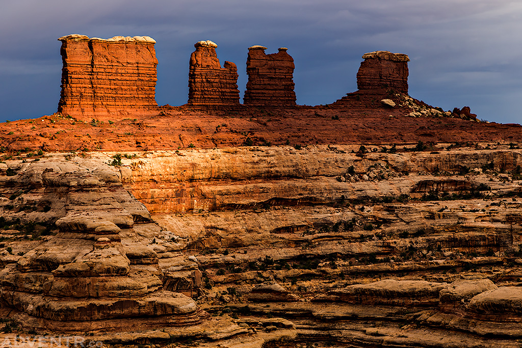
Chocolate Drops
CANYONLANDS NP – Horseshoe Canyon – The Great Gallery. A nice day hike into a spectacular canyon.

CANYONLANDS NP – Needles District. Chesler Park and the Joint x3, Other destinations include Druid Arch, Confluence Overlook (there are confluence overlooks in each of the three districts of Canyonlands NP), Newspaper Rock, Cave Springs Loop Trail, Scenic Loop Trail, Lost Canyon/Squaw Canyon loop. Virginia Park is one of two canyons that never saw cattle. It is pristine and is difficult to find and access. NP keeps it off-limits.
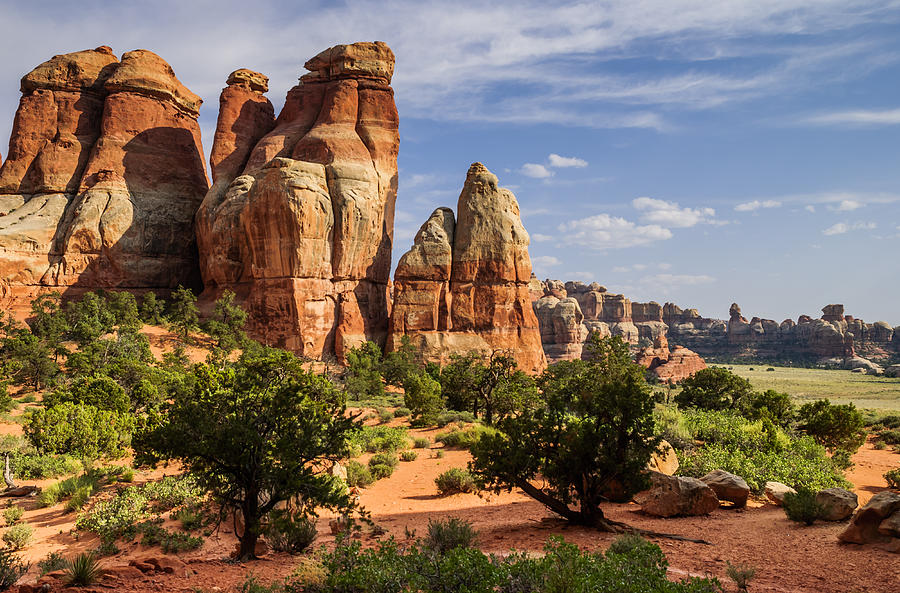
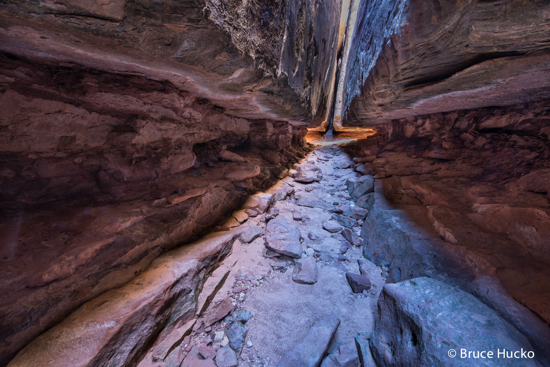
Chesler Park and the Joint. One of my favourite day hikes in the entire Colorado Plateau.

Druid Arch. Another good destination and very close to the access to Virginia Park.
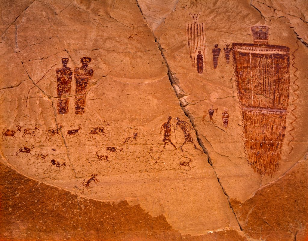
Salt Creek Canyon. Angel Arch and the All-American Man. A 3-day backpack in a great canyon, with good Anasazi ruins, one of the most beautiful arches and an unusual pictograph.


Corona & Bow Tie Arches. A favourite day hike near Moab. 

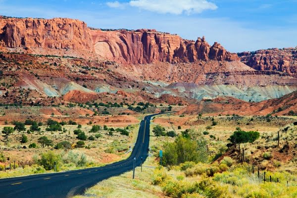
CAPITAL REEF National Park: Hickman Bridge, Frying Pan Trail, Fremont River Trail, Rim Overlook/Navajo Knobs x2 (a favourite hike), Chimney Rock Loop Trail, Cohab Canyon, Capitol Gorge to the Tanks (Pioneer Register).
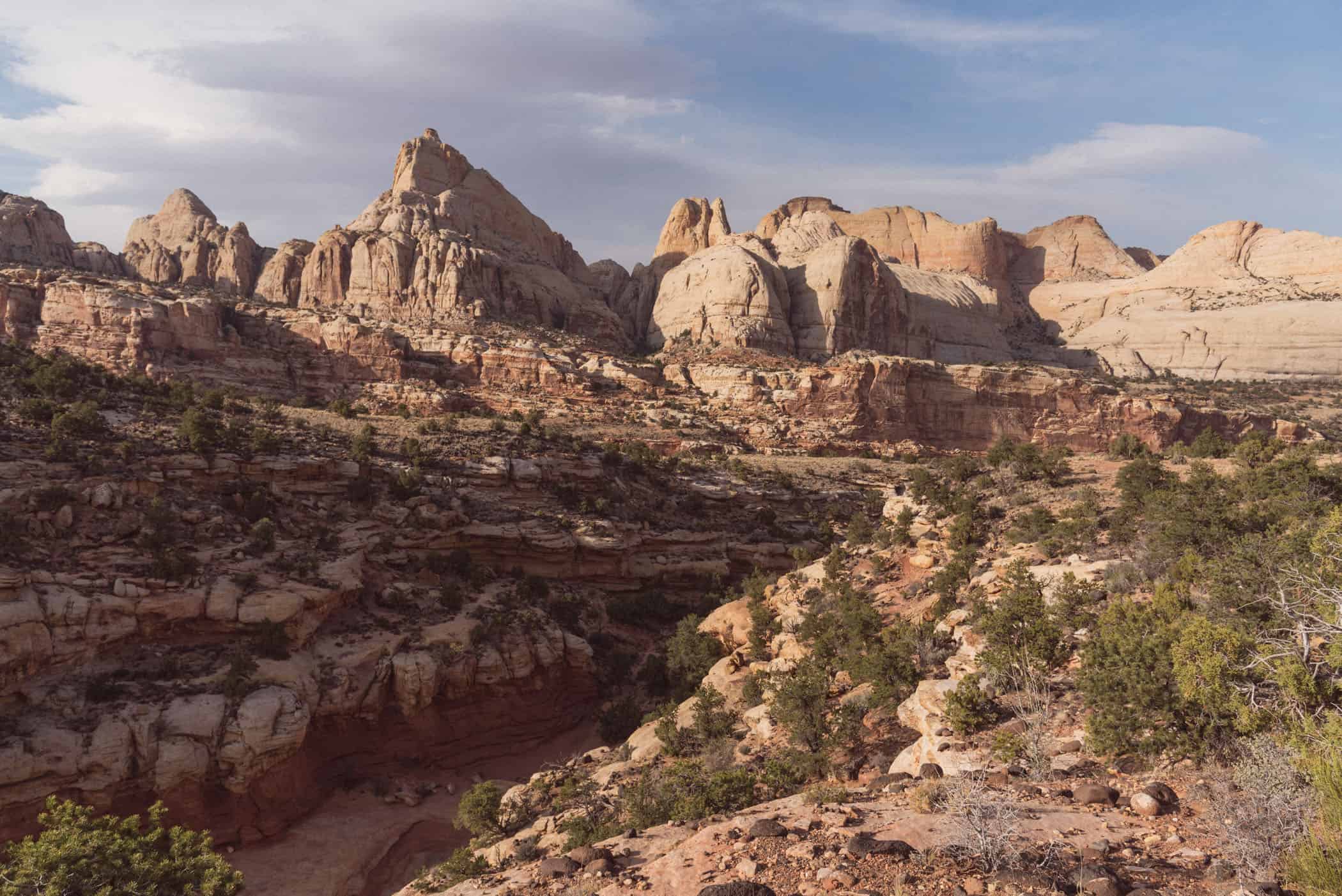
Rim Overlook/Navajo Knobs
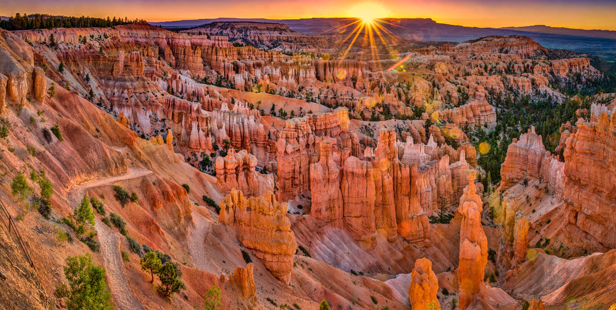
BRYCE CANYON NP: Fairyland Tr., Fairyland Point to Bryce Point, Queens
Garden T, Peekaboo Loop T, Navajo Loop Trail, Wall Street.
ZION NP: Emerald Pools T, Scout Lookout and Angels Landing, Weeping Rock to Hidden Canyon, Observation Point, Narrows: North Fork of Virgin River (Chamberlain Ranch to Temple of Sinawava backpack) x2, Subway (Kolob Terrace to the Subway), West Rim T (Lava Point to Angels Landing), La Verkin Creek and Bear Trap Canyon, middle fork Taylor Creek and Double Arch Alcove, Kolob Arch


North Fork of the Virgin River. 16 miles and 2 days in a deep canyon.
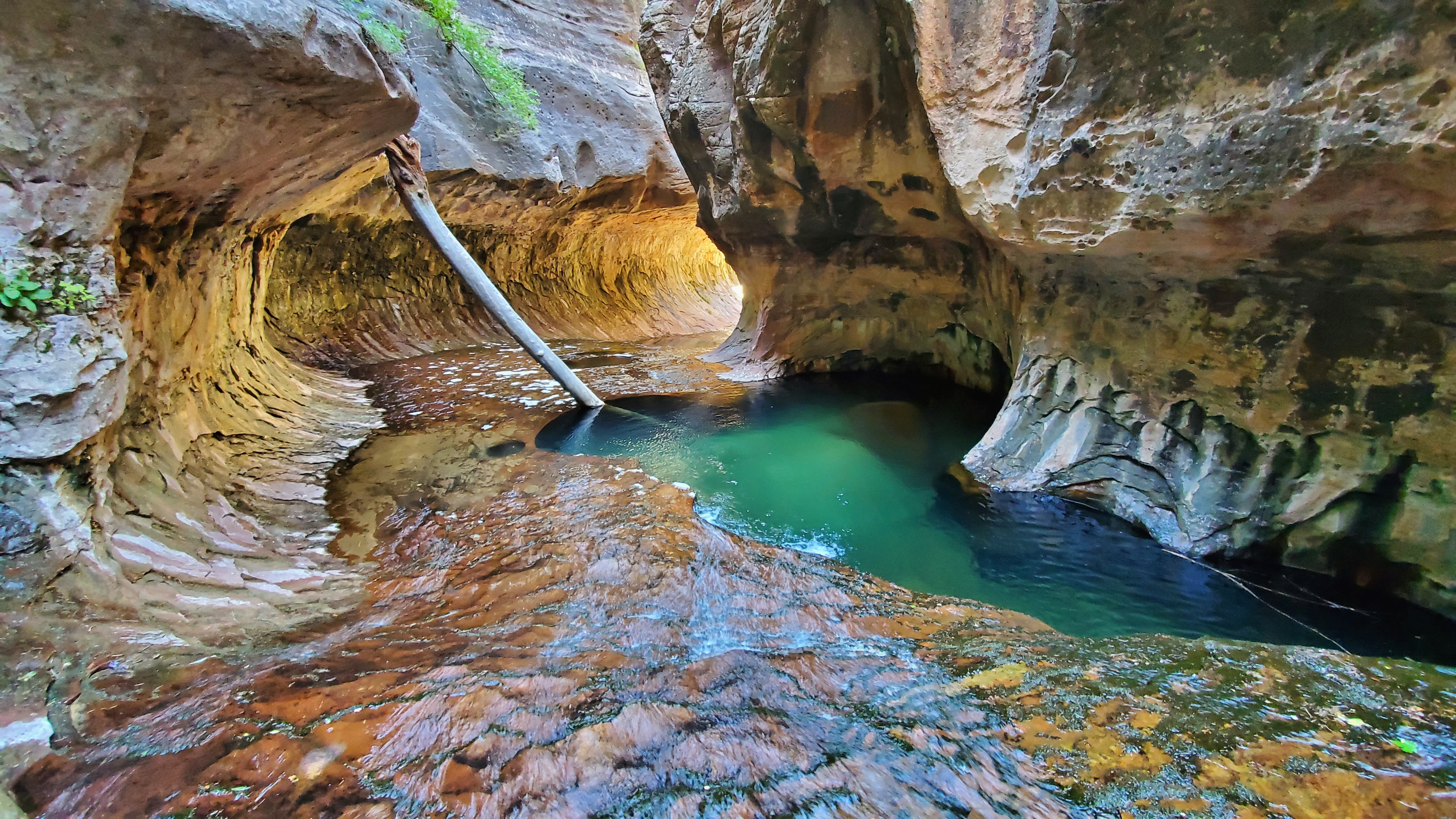
The Subway
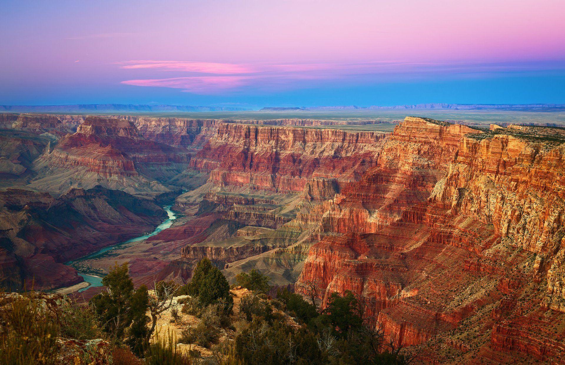
GRAND CANYON NP:
North Rim: Nankoweap to overlook, Rim to Rim day hike 22 miles.
South Rim: South Kaibab Trail, camped Phantom Ranch, Bright Angel Trail x 3
Raft the Grand Canyon from Lee’s Ferry to Diamond Creek at mile 225. Oct 6-21, 2016. Many day hikes from the river followed by milage from Lee’s Ferry: North Canyon 20.5, Saddle Canyon 47, Nankoweap Granaries 52.6, Carbon/Lava Loop 64.5, Phantom Ranch, Trinity Canyon 92, Shinumo 108, Elves Canyon 116.5, Blacktail Canyon 126, Stone Creek 132.6, Thunder River 133.7, Granite Narrows 135.2, Deer Creek 136.1, Havasu 157, Fern Glen Canyon 168, Parashant Canyon 198.5,

ARIZONA
HAVASU CANYON Accessed by helicopter or an 8-mile backpack, camp between Havasu and Mooney Falls, and hike to the Colorado River and back. This is my favourite backpacking trip in the world.

Havasu Falls


Mooney Falls
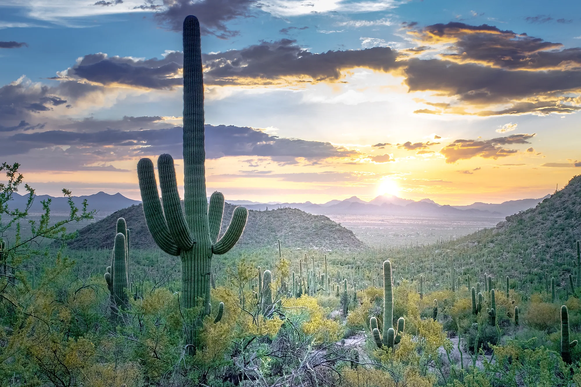
SAGUARO National Park
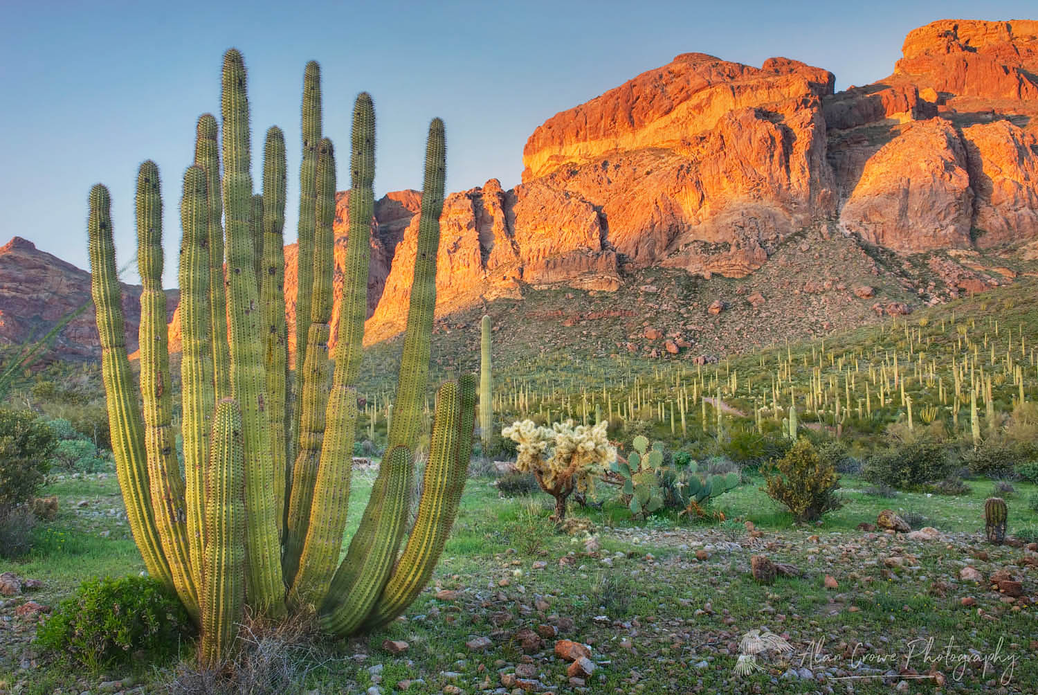
Organ Pipe Cactus National Monument, Arizona
CALIFORNIA
DEATH VALLEY National Park: Natural Bridge, Desolation Canyon.
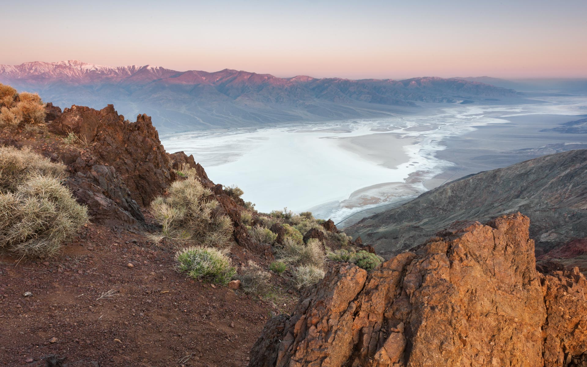
Bad Water from Dantes View

Eureka Dunes
JOSHUA TREE National Park: Lost Palms Oasis, Mastodon Peak Loop, Cottonwood Spring Nature Trail, Cholla Cactus Garden Nature Trail, Keys View Loop/Inspiration Peak, Skull Rock Nature Trail, Cap Rock Nature Trail, Wall Street Mill, Wonderland Wash, Barker Dam Nature Trail Loop, Eureka Peak

/joshua-tree-at-sunrise-103354885-59d28f34aad52b0011c0569c-5c23fb8746e0fb00019879e7.jpg)
White Mountains Bristlecone Pine – Bristlecone Pine

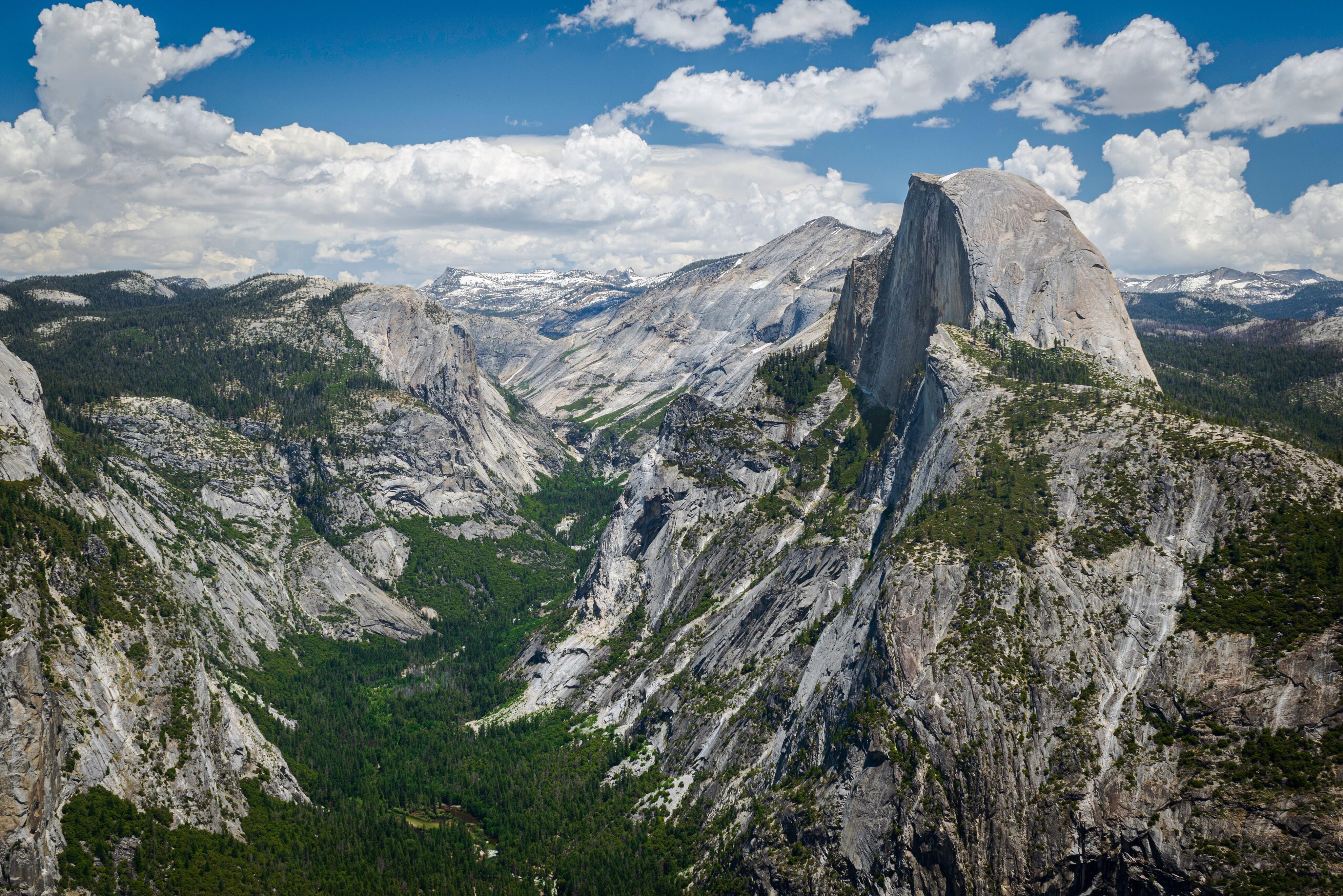
YOSEMITE National Park.
Vernal Falls→Nevada Falls→climb Half Dome

![Nevada Falls, Yosemite Valley [OC] [1080x1920] : r/EarthPorn](https://preview.redd.it/3sx94eiqceh31.jpg?auto=webp&s=2ec7c7b1a7d61724a88e7b75aa02444fd2320608)

Yosemite Falls
Glacier Viewpoint

REDWOOD National and State Park
