CAMINO PORTUGUÉS
There are many pilgrim paths to Santiago, but the Camino Portugués is the most intimately connected with the life and ministry of St James, his death and burial. Along this route at Monte Santiguiño, Santiago first preached Christ’s message of unconditional love and forgiveness thus helping to write the first pages of Christian history to the pagan populace (he reportedly only had 4 converts). He subsequently returned to Jerusalem to be martyred. His body mysteriously returned to the same spot – the boat carrying his remains sailed up past the Towers of the West – Torres del Oeste at Catoira to land again at Padrón, his body finally transported to Libredon – now called Santiago de Compostela. The Camino Portugués is thus both a starting point and an endpoint in the legendary Santiago story.
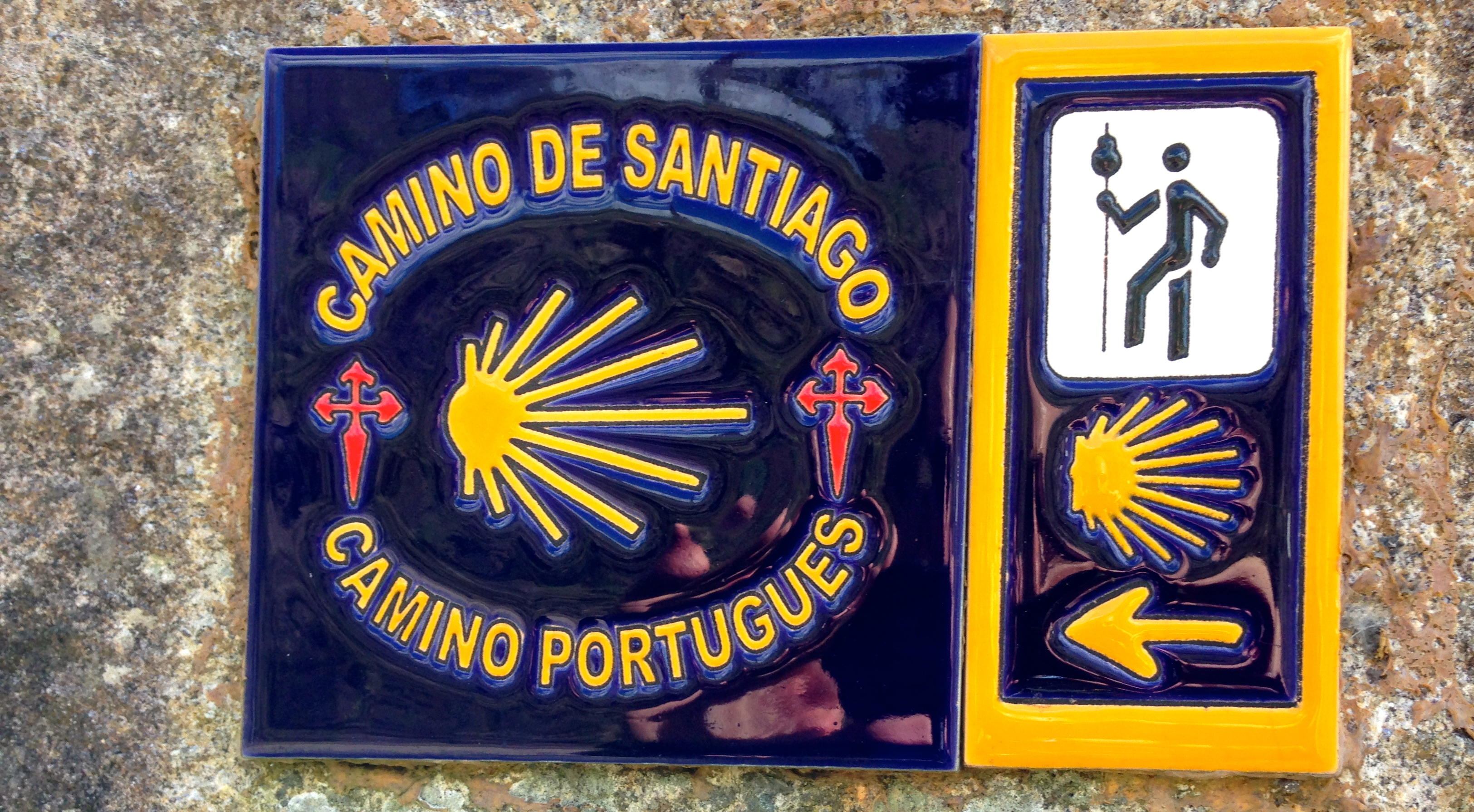
Much of the route follows the original Roman military road that connected Portugal with Spain and then France via the major ‘crossroads’ town of Astorica Augusta. Pass many Roman milestones the military used to confirm that one is directly on the Via XIX. Cross Roman bridges built 2000 years ago. But this all faded into obscurity for 800 years until the discovery of his tomb in the Roman town of Liberum Donum. The legend of the ‘Field of Stars’ Compo-Stellae was born just in time for the Christian re-conquest Reconquista of the Iberian peninsula from the Islamic caliphate based in Córdoba. The renaming of Libredon to Santiago de Compostela was to follow. The terrible image of St James the Slayer of the Moors Santiago Matamoros. This was the ideal image to spearhead the re-conquest but one far removed from the message of the love of God, self and stranger portrayed in the image of St James the Pilgrim Santiago Peregrino.
This later figure led the revival of Christian pilgrimage as early as the 10th century making Santiago de Compostela the third greatest pilgrimage destination after Jerusalem and Rome. Most bridges on the route were built during this medieval period, sometimes using Roman foundations. But it was not until the beginning of the 21st century that pilgrimage was revived and the most popular Christian pilgrimage route today.
Today the Camino Frances accounts for 63% (down from 85% 10 years ago) and the Camino Portuguese has become the second most popular route carrying 19% of the total (up from 6% in the same period, but still leaving the Portuguese way relatively uncrowded). Follow in the footsteps of Pagan, Celtic, Roman, Islamic and Christian wayfarers over millennia.
While rooted in pagan, Roman and Christian history, the Camino Portugués is open to everyone irrespective of gender or generation, colour, class or creed and from every religion – or no religion.. This inclusivity sets it apart from virtually every other pilgrim itinerary.
Many routes have been used over the centuries and may still exist today – in some form or another. It indicates the popularity of the cult of St James in Portugal in the Middle Ages that so many routes were available. There were two contrasting reasons for its decline – the arrival of the Industrial Revolution in the 19th century and the apparition of Fatima in the early 20th century that changed the focus of attention. The early 21st century has witnessed the awakening and renewal.
1. Central Way – the main historical route from Lisbon to Porto and Porto to Tui, just over the border in Spain where more than half of all pilgrims start the Portuguése Way ending in Santiago.
2. Coastal Way – This route is gaining in popularity and is well well-marked.
3. Seashore Path (Senda Litoral) Haphazardly waymarked but follows the seashore and beaches offering a distinct tourist vibe. The Coastal and Seashore routes converge at Caminha to cross the Minho estuary into Spain at A Guarda and then via Baiona and Vigo to rejoin the man Central Camino at Redondela.
4. There are many other variations in Portugal: Sea Route (commences in Ponteverde and goes up the Rio Ulla with crosses in the seabed), Caminho Nascete (29km route between Tomar and Fatima), Braga Way (Porto to Braga), several Interior Ways, Way of the Star (Caceres to Braga), Northern Way, and ways to Fatima.
It starts in Lisbon but relatively few pilgrims commence here (2,357 in 2016) even though 33.2% are on earthen tracks or woodland pathways. Pilgrims starting in Porto increase yearly (17,725 in 2016 with 32.5% on earth/woodland paths) and those starting from Tui/Valencia (21,931) make it the third most common starting point – after Sarria and St. Jean Pied de Port.
Many Spaniards start in Tui – you only have to be serf-propelled for the last 100 km to get your credential and half your sins forgiven. If they tell you they have walked the Camino, ask where they started and if they rode a bicycle. A well-known traveller rode an electric bike which seems similar to driving a car. He even posted it on FB not mentioning the ebike and impressed many. I don’t think these count, but they do, and many ride bicycles. As this will be my second arrival in Santiago, I will be sinless (except for the few I have accumulated in the last 5 years) haha.
The exact routes change frequently to help minimize time spent on tarmac and is why overall distances change. In the quest to avoid pavement, the route occasionally takes you through steep ascents and descents and often will bypass coffee and food shops
Why Walk the Camino de Santiago? We all have our reasons. Mine are not spiritual. I love to walk, am retired and thus have lots of time. It is a great way to see the intimately. I have rarely met any pilgrim doing the Camino for religious reasons. It is the cheapest way to lose weight and get into shape while enjoying oneself.
Tips for Walking the Camino in the Winter.
1. Pick Your Route. There are three ways from Porto, the Coastal (inland follows many roads – 35%), Littoral (actually on the coast following boardwalks and beaches but not well way-marked) and Central. I chose the Central for several reasons: a. It is the historical route walked by 60%. b. Accommodation should be much less of a problem at this time of the year when many aubergues are closed. c. It is better way-marked. I didn’t expect to see many people. d. It is less windy. e. Beaches are more for the summer and although I enjoy walking along the ocean, I rarely go to a beach.
2. Information. Buy the book Camino Portugués by John Brierley. It was up-to-date to 2018 and lists all the routes this way takes and all the variations available to have the best experience. All aubergues and hotels are included with excellent maps.
Another excellent source of information on all the ways to Santiago is www.gronze.com with an app, with great maps and information.
3. How to Stay Warm & Dry. Everyone has their own opinion – mine is based on 40 years of hiking and climbing in the Canadian Rockies and Interior Ranges of BC. Read “The Art of Hiking” for more details. The key to staying warm is staying dry, from the rain and your perspiration. Getting wet in cool environments is the fastest course of hypothermia.
a. Umbrella. Many walkers laugh at umbrellas, but I have hiked in the rain for decades with an umbrella, and often in some wind. It is rarely necessary to walk in driving rain. For my last two years of travel, I have not had a rain jacket. An umbrella allows complete ventilation. Mine is light, sits on the top of the pack, and with the handle under my chest strap, is hands-free so that I can use both my hiking poles. On most rainy days, the rain is intermittent and an umbrella is perfect – put it away and take it out easily – no need to take your pack off to put your jacket on. I always hike in shorts so don’t carry rainpants.
b. Waterproof Shoes. Most people wear light hikers, but here they should have XCR Goretex to keep their feet dry.
c. Warm Jackets. I always carry an 800-fill-down puff jacket. It is my main warm layer and functions as stuffing for my pillow. I bring it on airplanes and buses. I also have a thin 800-fill-down vest, wool gloves, a buff and a touque. I can handle -10°C weather.
I use a smart-wool long-sleeved shirt as a mid-layer.
d. Waterproof Sleeves. I don’t have these but they would be ideal as only your arms get very wet (if I pass a seamstress, I will have someone make them for me from nylon with elastic for the upper arm). Avoiding jackets (I sweat with even the best Gortex) is key. I wore my rain jacket (never buy a rain jacket with a liner – it defeats the purpose of layering) with the front folded back and the pit zips undone.
e. Pack rain cover. The G 40 pack needs a rain cover.
4. Food. The most difficult thing for me is finding lunch. In early January, there was a true dirth of places directly on the Camino to eat. Mercados are extremely rare except in big towns. Because of the emphasis on dirt and woodland walking, few towns of any size were encountered. I finally got smart and bought something for breakfast that I wouldn’t have to carry and some ham and cheese, (occ. tomato or avocado). The bread still posed a problem as it was nice to have fresh.
g. Coffee. I need coffee daily. Portuguese coffee stores take some getting used to – it is not Starbucks and there is no menu or a moca. The best solution is to have a cup and instant coffee.
MY CAMINO PORTUGUÉS
Day 1. Porto to Vairao Monastery (11km).
On Jan 2, with a forecast of rain for 4 days, I left the hostel, walked to the cathedral (closed on New Year and not open till 9), stamped my credential and started the 252 km walk to Santiago. Under the heavy rain, and with little desire to walk the suburbs of Porto with almost no attractions, all tarmac and lots of traffic (plus I wanted an easy day), I walked 150m from the church, entered the Sao Bento Metro station and caught the train to Trindade station (2 stops), and changed to the red line heading north (terminus Povoa de Varzim, just north of Vila do Conde) to the Vilar de Pinheiro stop. Avoid the express trains as they don’t stop here – I went past it and had to backtrack.
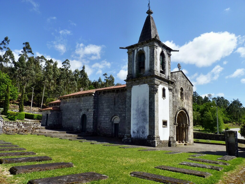
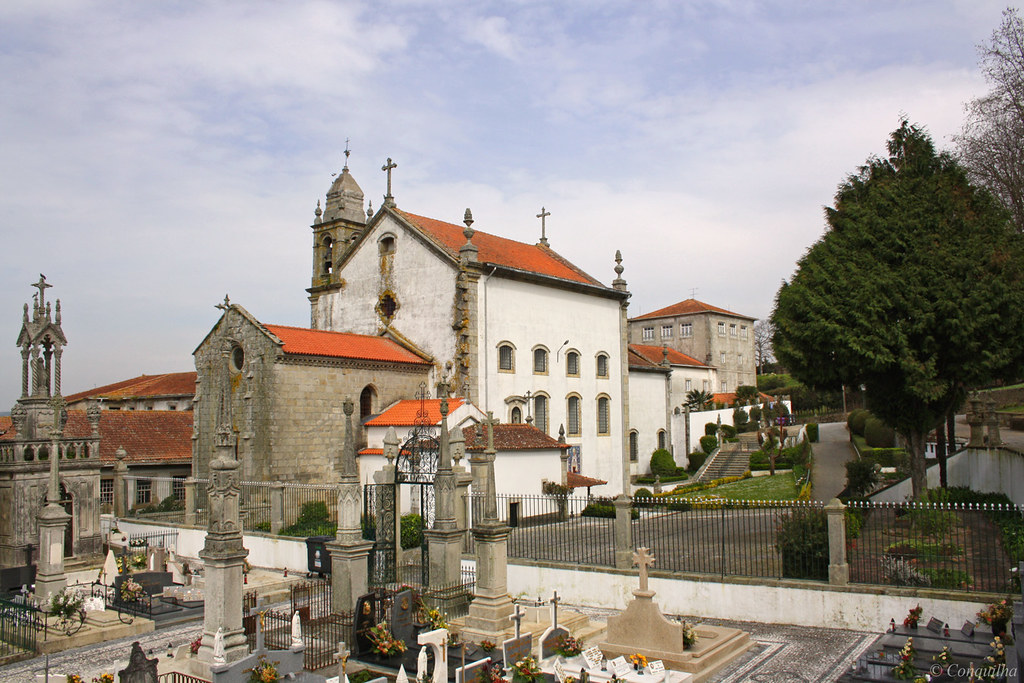
From Vila Pinheiro (this is the absolute outskirts of Porto, with houses to the right and fields to the left), turn right (east), walk a few blocks, cross the N-13 highway and go straight heading for the town of Mosteiro (turn left at the T-junction) where you can pick up the waymarks of the Camino Central. The next 4 km are on pavement. Portuguese drivers are not often kind – they speed on the narrow roads and seem to like to hit the puddles close to the sidewalk. At the marked detour (to avoid the heavy traffic and no sidewalks along the busy N-306 to Vilarinho), I turned right along quiet roads through the forest. After a few blocks, there is a lovely little church (closed) and a graveyard with some imposing crypts. I had lunch (breaded pork, rice, bread and a small salad – 6 €), my first real meal in a week, at a lovely little restaurant.
When I arrived at the Vairao Monastery, Alexander, a 52-year-old Russian gentleman was just being let into the gate. The sweetest older lady gave us a tour of the spartan facilities.
The Russian did not speak a word of any other language and the woman spoke only Portuguese, but everything was understood after a lot of laughs. He was 52 and had left Porto at 5 am, had no umbrella or rain cover and had to dry everything in his pack. The monastery provided a heated drying rack that was very handy. We were joined later by a 37-year-old Brazilian.
We walked a few blocks to a restaurant with wifi, hung out for a few hours, had a menu del dia (7.5€), visited the supermarket and went to bed early. The conversation was minimal but pleasant (he likes Putin and thinks the other candidate is just a mouthpiece).
Day 2. Vairao Monastery to Barcelos (31 km, 41,900 steps).
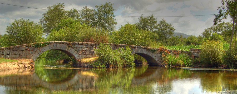
It had stopped raining at 7 when Alexander and I left the monastery in the dark. This is supposedly one of the best days as little walking is on roads, but instead on back lanes through the forest. During the walk, pass the most amazing rock walls that line both sides of the road. The 10+ foot narrow granite pillars part of some walls are amazing in themselves. Often they lean against the walls and form the anchor posts for grape arbours. After leaving Vilarinho, cross the lovely medieval Ponte de D. Zameiro with old mill buildings downriver.
After about 2 hours, with all the weight on my left foot, I slipped off a rock and created a strong shearing force across my heel – that is all it took to create a blister. This was rather disappointing as I did not have a blister on the 1600 km of my previous Camino walk. Happily, it didn’t affect my walking much.
It was a nice walk in the rain most of the way, but because there was so much in the countryside, there was nothing to eat. At about 1 pm, we hit our first restaurant – the woman here (I hope she was not typical of most Portuguese women) had one big argument. She wouldn’t let me sit outside, I understood 3 words on the menu and she was very disappointed when we only ordered the cheap soup (there was a nice place 1 block further along). By the time we walked through Barcelos to the “City Hostel”, I was pretty knackered. I admit I did not walk enough before starting on the Camino, especially with the weight and hills.
I would highly recommend the Barcelos City Auberge – it is nothing special but the restaurant next door has the best perigrino meal I have ever had: delicious soup, salad, lots of home-cut French fries and wonderful, melt-in-your-mouth roast beef, all for 6€. When in the hostel, I threaded my blister.
Barcelos was the first Portuguese County established in 1298 but its origins date back to the Roman period. It retains much of its medieval atmosphere with the oldest remaining structure being the stone walls. The national symbol of Portugal and logo for Portuguese tourism, the famous brightly coloured cockerel (rooster) originates here.

The town has several churches just as you cross the river Cávado over the medieval bridge built in 1328. This bridge was a great spur to the development and prestige of the town and facilitated early pilgrims to Santiago.
I regrettably did not eat at the aubergue the first night. When I tried to find somewhere to eat in town, the only thing open before 7 pm was the ubiquitous pastry shops – they seemed to be every second business – Portuguese love sweets and coffee. For dinner, I had tasty veal in a mushroom sauce.
Day 3. Braga. I decided to take a day off. After only 2 days, I was 60 km closer to Santiago. Braga is a famous city most easily accessed from Barcelos and I wanted to see it. A short rest from walking would not do me any harm. The blister would do best without a long walk. The walk to Ponte de Lima was 35 km, a big day. I needed to wash some clothes. I didn’t mind having some new walking companions. Danilo and Alexander, like so many on this Camino, were on a 2-week vacation and could not afford to have a day off or even a short walking day.
Use the www.transdev.pt site, the only bus company that goes to Braga, a very round-about “city bus” route that takes an hour.
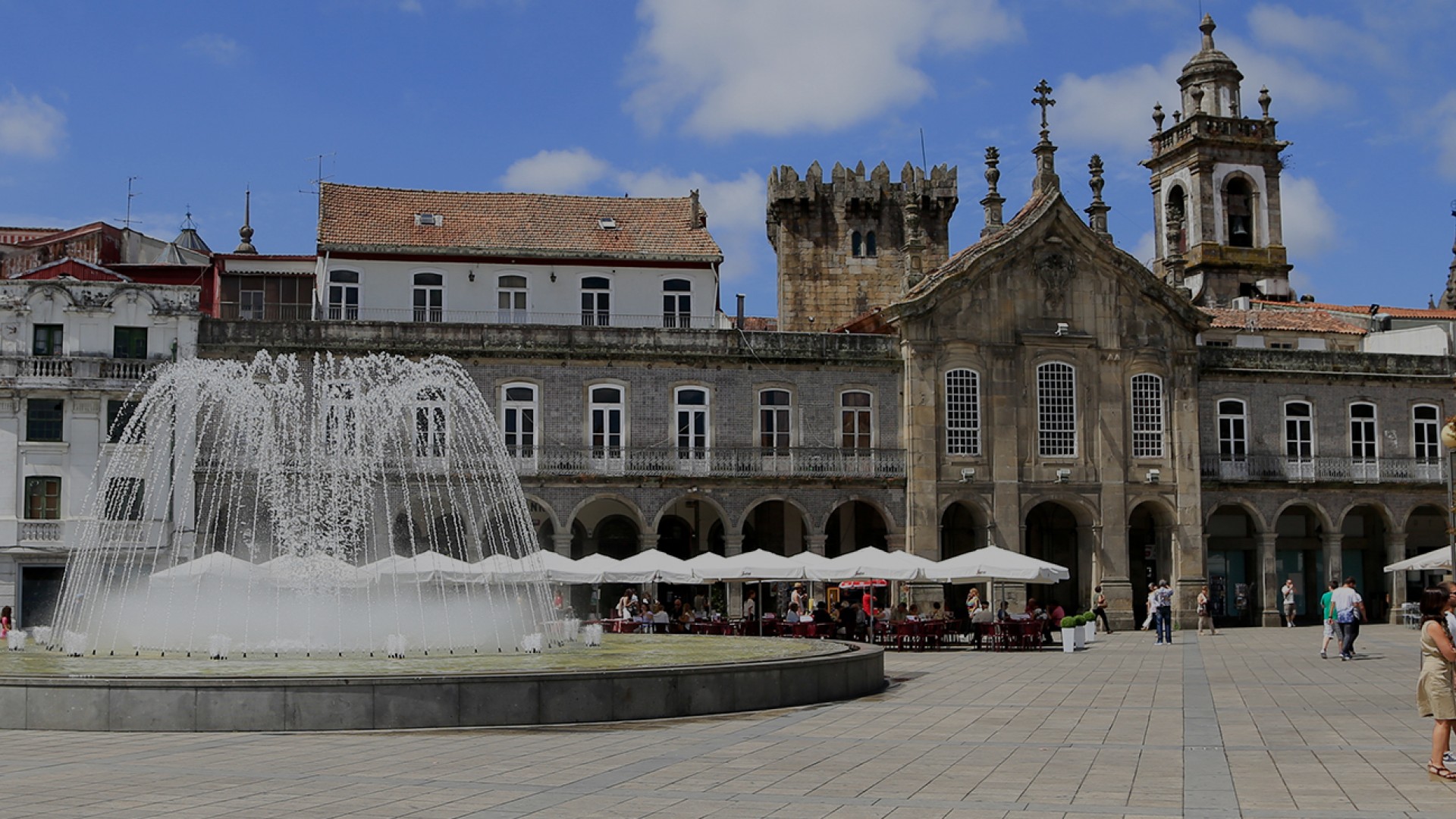
BRAGA. Sometimes referred to as the ‘Rome of Portugal’, the Central District of Braga is Unesco World Heritage listed and has more than 30 churches and several national monuments.
The most visited tourist attraction in Portugal is the Bom Jesus church above town. I wandered around visiting some of the seemingly hundreds of Catholic churches. The Cathedral Se (foundations date to 1070 when they replaced an earlier mosque). It had a lot of nice carved statues (avoid the 2€ fee by going around to the front door).
Take the #2 bus up the mountain to the Bom Jesus church. It stops at the bottom of the stairs and the funicular, which I took up past spectacular rose trees lining the steep climb. The church itself is average except for the diorama in the nave – Christ on the cross and a bunch of Roman soldiers.
Behind the church is a park with several artificial water features – a cave with stalagmites/sites, a grotto, an artificial lake at the top with rowboats, a park, a village of hotels, and several chapels. These 8-sided chapels all have dioramas that are well done. The highlight is the panoramic views of the city and the marvellous steps back down to the bus stop. The stonework, many statues of saints and wonderful fountains with water coming from various orifices are a tourist attraction in their own right. Several 8-sided chapels on the stairs show the 12 Ways of the Cross.
The Ways of the Cross is one thing that interests me in Catholic churches – I have never seen the design repeated – and these are the best with great dioramas in each. (I found all 12 Ways of the Cross in Jerusalem – they are not easy to find – the best are at the end when you go through an ancient church at the back of the Church of the Sepulchre where Jesus was supposedly crucified and rose from the dead).
Back in Barcelos, the father/son Koreans were replaced by a young Korean man with bad blisters. But he too was determined to finish despite the pain.
Day 4. Barcelos to Ponte de Lima. 34.7 km
This is the longest but the most beautiful stage. It includes two hill passes separating the river valleys of the Neiva and Lima rivers. Nearly half is on pathways through vineyards and woodlands. At about 17 km, cross the Ponte das Tabuas, the ‘Bridge of Boards” over the river Neivea dating to the 12th century. The present medieval stone structure is emblematic of the pilgrim way.
I met a very unusual person at about 20 km. He was a Polish man in his late 20s walking in the opposite direction (south) heading for Fatima. He had an enormous backpack, almost a metre square, with no waist strap and two heavy jackets draped over the back. In addition, a large bag hung from his front, counterbalancing what was on his back. Tall and emaciated, his all cotton clothes were dirty, and I guessed he was camping. He wasn’t interested in my advice on where to stay and eat in Barcelos. A marble cross and rosary beads hung around his neck. This is what religious fervour does for one.
After another 10 km cross the medieval Ponte de Barros over the Rio Trovela.
Portuguese people are not the friendliest and Ponte de Limans are the worst – never a smile or acknowledgement and usually a surly look.
Ponte de Lima is attractive with the visitors centre in an old fort/prison. There are lots of cobbled streets and medieval buildings. It prides itself on being the oldest town with the oldest market in Portugal.
The bridge over the wide river Lima originates from a 7-arched Roman bridge built in the 1st century when it was crossed by Augustus. The present medieval stone bridge was built over the Roman bridge in 1368 and has 15 arches with a church built into the north end.
Warning: the last place with food for the next many km is on the south side of the Ponte de Lima bridge – and the aubergue is on the north side. This is also the last ATM until Valenca, a distance of almost 40 km. Besides the expensive restaurant across the street from the aubergue, the only other business on the north side of the bridge is a “snack bar” with a mediocre meal. The young Korean and I were the only ones in the lovely hostel. On a short holiday, he left early the next morning to walk almost 40 km to Tui.
Day 5. Ponte de Lima to Rubiaes. 18.6 km + 3.8 (going back and forth between the Auburgue Escola and the town centre twice). I called this day the “walk in the woods” or the “day of the barking dogs”. This is the first-day natural walking paths accounted for over half the route. There were no main roads at all.
After about 3.3 km is the first evidence of the Roman military road XIX, the bridge over the Rio Labruja.
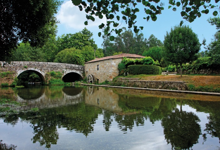
The road originally went between Braga, Portugal and Astorga, Spain.
The river has a trout farm and lovely cascades. Before Revolta, the wind under the freeway several times and the dogs start to appear. Every yard seems to have a rabid, violent animal that wants to tear out your throat – there must have been at least 40 of them. The small bar in Revolta is a welcome site and the last place to get anything to eat until .8 km after the Auburgue Escola in Rubiaes.
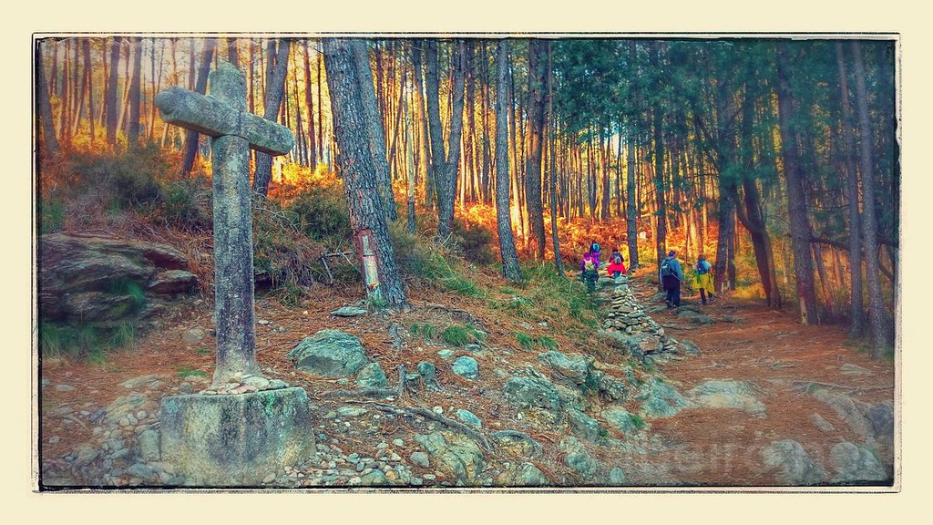
After Revolta is the steepest accumulative climb on the entire way as one ascends the Labrujua valley to the high pass through the mountain ridge and into the Coura valley. There are several steep ascents to the pass and some interesting sites. The remote cruceiro (cross) Cruz dos Franceses or Cruz dos Mortos was about the ambush that took place here on Napolean’s troops during the Peninsular War (1808-1814).
At the top of the pass (called the Alto da Portela Grande) are views down to the Coura Valley. Ancient grain mills (actually maize, the ingredient of the common local bread) are next to the path.
At the bottom of the steep descent, I met an interesting young couple from Paris. They had started on the Vesley section of the Camino just southeast of Paris (one of the four ways through France, but also the one probably least commonly walked). After 1700 km to Santiago, they continued on the Camino Portugués and planned to walk around the perimeter of Europe. They were attempting to live a ‘freegan’ lifestyle and many of their days cost them less than 2€ as they frequently camped, knocked on strangers’ doors and asked to sleep there, scrounged past-date food from supermarkets and hitchhiked when they needed a ride.
As you approach Robiaes, pass the 12th-century Romanesque church dedicated to St Peter (Igreja de Sao Pedro de Rubiaes). In front is a historic military marker on the Via XIX that has been hollowed out to form a sarcophagus.
Just below the church, meet the main highway and a sign for Rubiaes. The Aubergue Escola (as it is referred to in the book) is called the Aubergue de Sao Pedro de Robiaes and escola is not mentioned. As a result, I walked down, crossing the Roman bridge Pons Romana II over the Rio Coura and turned right to hit the Mercado and just above it the Restaurant Constantino.
The store owner informed me that the Augurgue Escola was .8 km back up the hill. I walked back along the road, checked in and found out that the only food (the restaurant next door to the auberge was closed for the winter) was the Constantino, so I trudged back down, ate a monstrous meal (portions here seem very large) and then back up the long hill for the second time.
Expecting to be alone at the hostel, a Hungarian couple and a young man from Lisbon arrived after walking over 30kms from before Ponte de Lima. They were all exhausted.
Day 6. Rubias to Tui, Spain. 23.3kms.
I had a relaxing 9 am start as the day was shorter and involved only a short climb to the watershed of the Coura and Minho Rivers and then a long, steep descent into Valenca, on the Portuguese side of the border. At the top of the pass across from the church was the Café Castro for a welcome coffee, an unusual start to the day where almost everything is closed. Again this was the last food until Valenca. Apart from the stretch of the main road into Tui, this stage was split between natural pathways and quiet country roads. The Minho River now becomes the Mino as you cross into Spain. The Roman military road XIX is followed most of the way. On the outskirts of Valenca, I encountered my first ATM in about 40 km and loaded up with cash (I was down to my last 3€). Very hungry, I was refused service at the first restaurant and the second one had an ala carte menu I didn’t understand. Eventually, the route went through the Valenca Fortaleza (fort) standing guard over the River Minho with its imposing double walls.
Inside the fort is a tourist mecca of souvenir shops, bars and restaurants. In the fort, in front of a church is the Roman military marker dating to 43AD (2.15m high, 54cm diameter and marked with the distance of 42 miles from Braga).
Starved, I had another disappointing European hamburger. They don’t understand: the bun usually disintegrates in your hands, they add odd ingredients (egg, ham), don’t use mayonnaise, mustard or pickles and never char the hamburger patty that often has fillers.
After the fort, one crosses the Mino River into Spain to arrive at the town of Tui. The time zone changes and loses an hour. It was a nice walk up through a medieval town to the cathedral with the hostel behind.
My friends from Rubiaes were there. The Portuguese guy had the worst case of blisters I have seen. I threaded at least 10 to try to give him some relief. I certainly would have stopped walking with feet like this, but he was determined to finish and in a much faster way than me. All my companions in the auburgue continued to Redondela, 38 km away and a huge day.
I wandered down to the busy tourist district and made my second food mistake of the day by ordering pizza. The crust was thick and it had too much cheese. A Sunday, there were no mercados open to buy breakfast. I had set my watch the wrong way and returned to the auburgue an hour after it closed. I banged on the door several times and woke up my friends who thankfully let me in. If not, I was not sure what I would have done.
Day 7. Tui to Porriño. 20.1 km.
With a much earlier start at 7:15, I stopped at the Monxas & Convento das Clarisas in the medieval town as the door was open and a light was on. Two elderly nuns were praying in the cloister. The church had some lovely ways of the cross (black and white paintings). Pass the Convento Sto Domingo (the Dominicans have been associated with this site since 1330). Just after exiting the town, pass (but don’t cross), the medieval Ponte de Veiga (medieval bridge) over the Rio Louro. It was 1½ hours walking in the dark through some deep woods. At 5.8 km pass the Cruceiro San Telmo, also known as the ‘bridge of fevers’, where San Telmo fell sick and died of a fever in 1251 on his way back from a pilgrimage to Santiago de Compostela. A cross marks the spot.
Walk variously on a wide paved road that crosses the big N-550 highway, through woods and hamlets. Seeing the waymarks was difficult, but I was saved twice by locals who pointed the right way.
At 8.9 km, arrive at the spectacular paintings by Xia Castro of a stairway, Santiago Matamoros and a self-portrait of the painter wearing a beret with a scallop shell on the front. 130m past the paintings, come to the major decision of the day. One can continue straight through the soulless slog of the major industrial area of Porriño or turn left for a much more pleasant scenic route through the woods. Interestingly, the waymarks for this turn were painted over with black paint and many atypical yellow arrows were painted on the road. This appeared to be an unfortunate attempt to disguise the favoured route for commercial gain (my guess it was the restaurant with several signs down the road). This also occurred in the medieval period to steer pilgrims past a business. This route is 1.7 km longer than the industrial route. Once you enter the woods, waymarks are obvious at every turn.
Porriño is an industrial town (18,500) largely employed in quarrying and finishing granite for building and decorative purposes. On the outskirts of Porriño, turn left to walk the lovely path beside the Rio Louro rather than the route along the N-550. Just before the bridge that takes you into the city is the Aubergue Peregrinos Porriño, the huge, modern municipal aubergue has a massive glass lounge.
It didn’t open till 3 pm. I went into town, bought food for a late lunch and breakfast and had a few coffees in the sun at a nice bar. The other aubergue, the Aubergue Camino Portuguese was closed.
Like all aubergues in Spain, this one too required a phone to receive an SMS with the password to access wi-fi. After a nap, I returned to the bar for more wi-fi access and coffee before the aubergue closed at 9 pm. I was all alone in my 48-bed dorm room. Two Spaniards and a Finnish woman were in the next dorm room. Another odd thing about Spanish aubergues is that you must be gone by 8 am.
Day 8. Porriño to Redondela. 16.1 km (the 800m climb adds 4 km for 20.1 km).
16.1 km looks like a walk in the park but the challenge is the steep climb up and very steep climb down with 87% of the route on asphalt that is hard underfoot. After 3 days of sun, the forecast was for rain for the next 3 days. True to form, I woke up to heavy rain. It was also cold and windy, making a lousy day to walk. On the descent, pass a Roman milestone Marco Miliário again marking the military route Via XIX, evidence that this is the original pilgrim way to Santiago.
On the pass and in Redondela, the waymarks were difficult – I have never had to ask directions so many times. The yellow arrows have changed to a cream colour and are sometimes on the road, making them easy to miss. I stayed at the Casa da Torre (6€), a renovated 16th-century manor house, the municipal aubergue. I found the sign obscure and walked a km past it. Again I had another argument with the host woman – these guys are relentless and cannot validate that you had a problem. Marry one of these women at your peril.
Redondela sits on the estuary of the Rio de Vigo and has many pilgrims arriving from the coastal route from Vigo. It has a lovely atmosphere along the river and town park. But it was a Tuesday and all the restaurants were closed. I will never get used to the hours in these countries. See the 15th-century Iglesia de Santiago, emblematic of the Camino with a statue of Santiago Matamoros above the fine rose window and other Santiago motifs.
Day 9. Rodondela to Ponteverde. 20.2 km
Starting at sea level, climb through the forest to Arcade. With an early start, it didn’t rain for 30 minutes, but then began in earnest with heavy rain, wind, thunder and lightning. Thankfully the wind was from the south and at my back. After about an hour’s climb, get the first view of the gigantic Ponteverde estuary far below. The backs of my legs were soaked. After 1½ hrs, I found a nice refuge 200m off the route in a lovely coffee shop in Arcade. I climbed back to the marked way, descended a steep alley behind the coffee shop I had just been in and crossed the busy road. The routing of the way in Spain can be very irritating.
After Arcade, drop down to sea level and cross the top end of the estuary across the Ponte Sanpaio, the handsome bridge built in 1795 over earlier foundations – another lovely medieval bridge. It was another steep climb up to another high point on what looked like a Roman road and then down to Ponteverde.
The municipal aubergue is 1.5 km before central Ponteverde. It is a lovely building with heated floors and a large lounge. The only other customer was Roland, a 52-year-old German man from Munich. He plays bass and tuba in a band and is the frontman. They play German beer hall music and hard rock all over Europe and once in the US and Israel. He had travelled to A Guarda, walked on boardwalk and beach and saw no one else. He rejoined the Central route at Redondela. We enjoyed each other’s company and agreed to walk to Caldas de Reis the next day.
Day 10. Ponteverde to Caldas de Reis. 22.2 km.
Raining hard at 7, it stopped and didn’t rain for the rest of the day. We hit a coffee shop after the aubergue and had a leisurely hour. The route climbed 8.3 km moderately to San Amaro where we had another nice hour over lunch. It was 3 hours downhill to Caldas de Reis. This turned out to be my most enjoyable and easy day of walking.
Caldas de Reis has a population of 10,000 and sits between the Rios Umia and Bermaña. It is famous for its hot springs that have been 40°C for millennia and was a major spa on the Roman road XIX. The parish church is dedicated to St Thomas a Becket, Archbishop of Canterbury (1118-1170) who made the pilgrimage to Santiago 3 years before his assassination.
We stayed at the Aubergue de Caldas de Reis (Posada Dona Urraca) with some new people including a young woman from Boston going to MIT and setting up a business in Portugal. Most Americans have never heard of the Camino, no less the Portuguese way. We had a delicious seafood meal at the nearby restaurant. Unfortunately, we did not make it to the free hot springs.
At the hostel was an unusual fellow. From Cadiz, Spain and now 68 years old (but he looked and walked like he was 80), he has walked 110,000 km in his life. By the time he was about 50, he had walked 60,000 km through Russia, Tibet, and India (he met the Dalai Lama in Daresalam) and all of Europe. He met the Pope in Italy and carried a binder of newspaper clippings to prove it all. He had no money and was working in the hostel for room costs. Roland was very generous and gave him some money and everyone gave him cigarettes. He said that he was leaving the next day to walk the 1,200 km to Cadiz (I think he was exaggerating the distance) and it looked like he was camping along the way.
Day 11. Caldas de Reis to Padron. 19.1 km
This was another great day. Only 3° in the morning, it did not rain or blow all day, but was cold, just like the previous cold and non-rainy days. Roland and I seem to like the same relaxed pace with frequent coffee and an hour for lunch. He was an interesting guy.
We stayed again at the 6€ municipal aubergue, a gorgeous old stone house that was renovated. Padron is one of the most famous Santiago places: it is where he gave his first sermon and where his body was bought from Finisterre (the myth says that after being beheaded by Herrod in 44AD, he was put in a stone boat that mysteriously sailed itself across the Mediterranean and around the west coast of Portugal and Spain landing at Finisterre. The body was then brought to Padron before being taken to Santiago to be buried. Above the aubergue, we climbed the 130 steps to a chapel and cross dedicated to where Santiago gave the sermon. We went out for seafood, and two new women arrived at the aubergue. I love it when only a few people are in these gigantic 50-bed dorms – one can spread around, open the windows and have complete freedom.
Day 12. Padron to Santiago de Compostela. 25 km
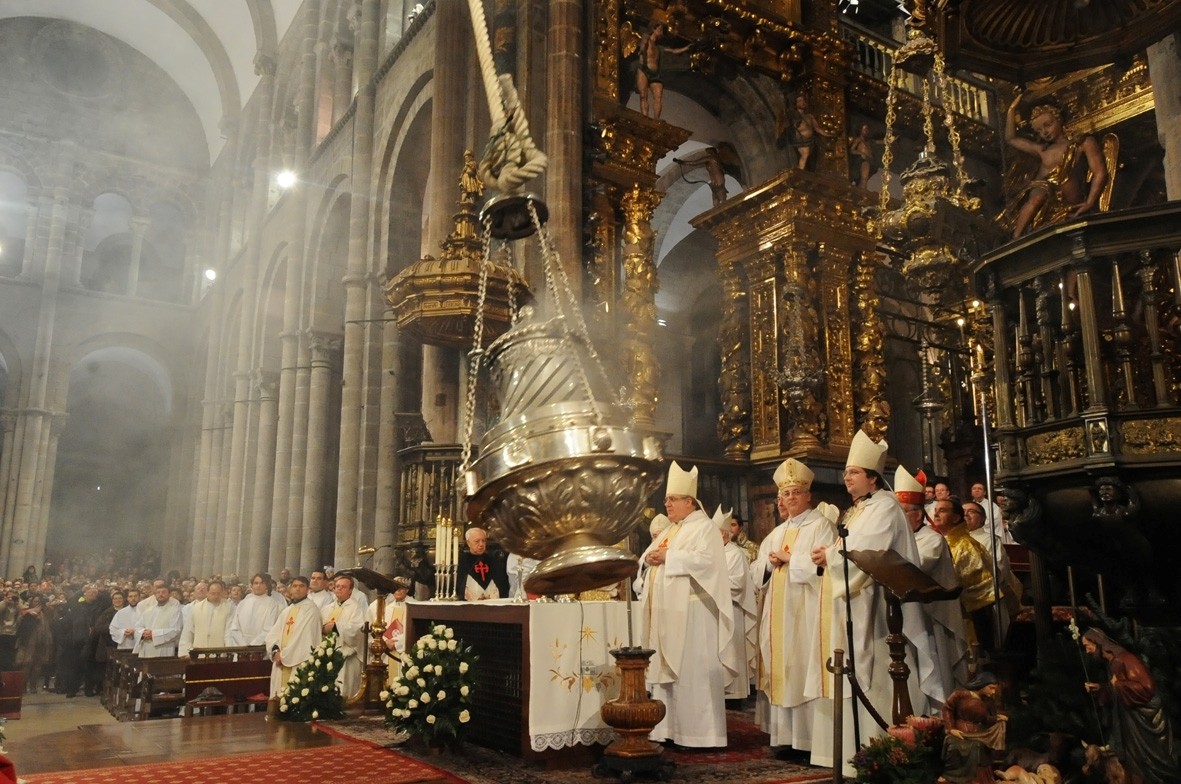
One of the main attractions at Santiago is the mass at noon most days when the gigantic censor is swung with the help of 6 assistants across the nave of the church. Originally it was to disguise the smell of all the pilgrims in the church.
To get to Santiago by noon, I was up at 4 and started walking soon after to make it. In heavy rain and dark for 4 hours, it wasn’t much fun. The rain stopped by 7 but there was fog/low cloud. It was uphill (+340m) to Milladoiro then roughly level for the last 7 km. I arrived at the Cathedral at 11:50 but couldn’t enter the church because I had my backpack and no packs are allowed inside for security reasons. I whined big time, and the guard let me put my pack beside the door and enter for mass.
An elderly nun started and sang intermittently with the sweetest voice in the world. The mass lasted about 50 minutes and I didn’t understand a word. Unfortunately, they only swing the censors on ‘special’ days. I looked around the church and joined the crowd that parades behind Santiago at the head of the nave.
We then went down to get our credentials (mine is non-religious), had lunch and checked into a real hostel, Aubergue Blanco just below the official peregrino office. For 12.5€, one gets a warm room (too warm), sheets, hot showers, a towel, plugs at your bed, a bed light, a secure locker, 24-hour entry and potential laundry. It felt great to put away clothes and hiking shoes I didn’t plan on using for a long time, sit in a warm common room with wi-fi and relax. So much for 6€ Camino dorms.
SUMMARY OF MY CAMINO PORTUGUÉS
I walked 245 km in 11 days for 22.3 km per day, a little less than my previous 24 km/day. Besides having some long days, the most convenient stops averaged about 20 km apart. I had 7 days of rain and 5 days of clear, cold weather. I stayed in the cheapest municipal hostels for 5€ (Portugal) and 6€ (Spain) and treated myself to some luxury on my last night. One great advantage of walking in the winter is having entire hostels to oneself. If I were to do the Camino Portugués again, I would walk the Senda Litoral (seaside) from Porto to La Guarda and join the Central route at Redondela. It is flat walking along the ocean and few people walk it.
My biggest challenges were carrying a heavy pack (16kg when most peregrinos carry less than 8) and 2 blisters that I will blame on the insoles in relatively new hiking shoes (both threaded and relieved by cutting off the back outside corners of the insoles).
I encourage walking alone. You will meet a variety of walkers and it is always the best way to meet others.
If I had to choose between the three Caminos I have walked, I would walk the Via Podiensis between Le Puy France and St Jean Pied de Port for its great scenery, rural route, French food and few pilgrims.
If I were to walk another Camino Santiago, I would think of Veselay (Paris to St Jean Pied de Port), Norte (along the north coast of Spain or Primativo (from the north coast of Spain to Santiago). But I think the walk from Canterbury, England to Rome would be interesting and preferable to them all but the Via Podiensis.

:max_bytes(150000):strip_icc()/GettyImages-521059072-5a43aa86845b34003786cccd.jpg)
